
It's better Friday, but not by a lot. Sunshine will struggle as lots of water vapor remains suspended in the atmosphere. We're working the temps into the 50s to near 60 (sunshine dependent).
Friday night, a front will approach, triggering a few showers into Saturday morning. Guidance seems to keep them around for a bit, so many of us will start off soggy, then transition to some sunshine in the afternoon.

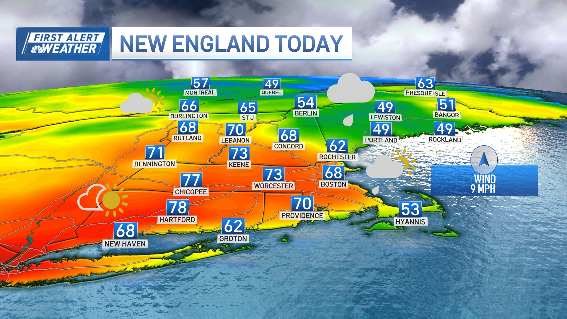
We're milder overall, with highs in the low 60s areawide. Unfortunately, Cape Cod will be last to see the clearing (later in the afternoon), so it's not the best of days there. Sunday dawns brighter and cooler, with a steady northwest wind.
Get Boston local news, weather forecasts, lifestyle and entertainment stories to your inbox. Sign up for NBC Boston’s newsletters.
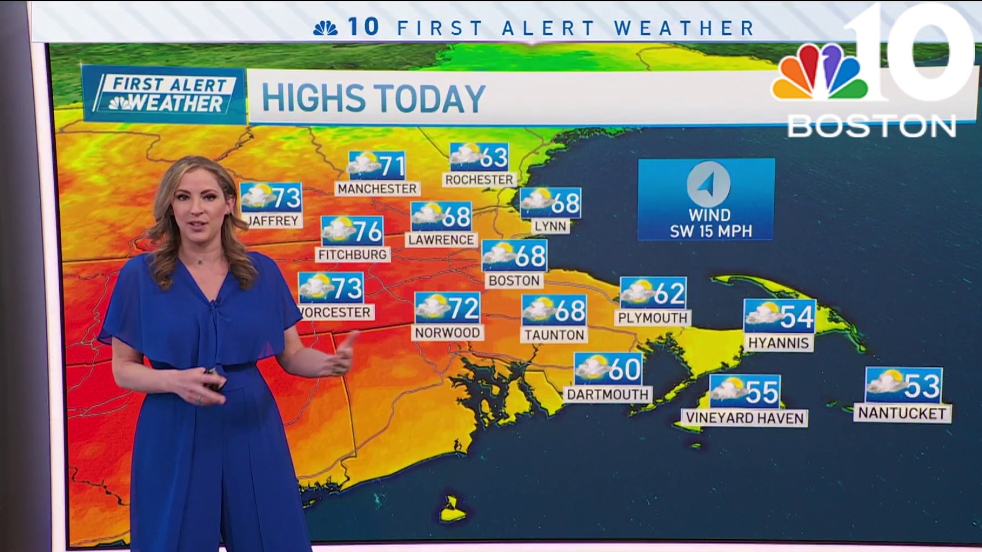
Highs struggle to make 60 in most spots, but there’s plenty of sun on our side.
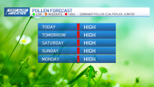
Next week continues the mostly dry trend. Our next threat for showers will be Wednesday. Cool readings in the morning have us watching for the frost potential in the suburbs both Tuesday and Thursday.
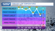
Right now, it doesn't appear that we're in the deep freeze, but isolated spots could dip near freezing in the cool, dry air.
Weather
Be safe and have a great weekend!
