
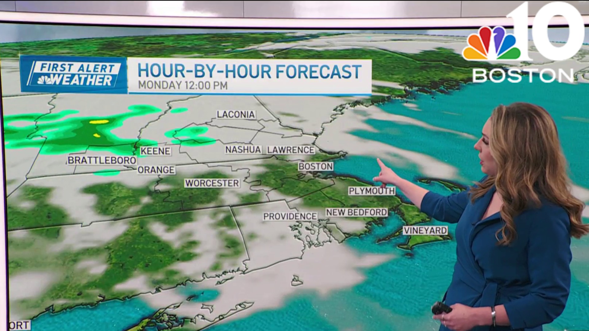
Bouts of heavy rain and strong winds will batter us Friday morning as the storm moves through. Gusts could top 40 miles per hour at times along the coast, and in isolated spots away from the coast (particularly the Worcester Hills).
While the heaviest rain moves out after midday, the winds only ramp down to the 30 to 35 mph range. Temperatures remain on the mild side throughout the day.

The weather improves this weekend
Get Boston local news, weather forecasts, lifestyle and entertainment stories to your inbox. Sign up for NBC Boston’s newsletters.
On the back side of the storm Saturday, our winds will shift to the west and northwest, drawing in cooler air both at ground level and aloft.
That spells plenty of cloud cover through the day with more April-like temperatures all around. Highs struggle in the low and mid-50s, and there's the possibility of a passing sprinkle.

We're looking good on Sunday, at least for the first part of the day. Clouds will once again race in with a slight shower threat late-day. Despite the sound of it, many of us stay dry for a good portion of the weekend.

We have mild temperatures for the Boston Marathon
The Boston Marathon is still looking mild, but likely falling short of "too warm." Highs should level off in the mid-60s with any morning clouds scooting out of sight early.
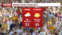
There will be a steady breeze from the northwest, so there is a tail wind component at times. Overall, it's not a bad forecast for spectators and runners alike.
Do we have a big warm up next week?
We're wringing our hands over the possibility of some big warmth next week. If we get a warm front through on Wednesday, 70s could rule the land for a couple of days. Still need the weekend to work out the kinks.
Enjoy yours and be safe!
