
Strong storms blew through southern and western New England on Saturday, possibly causing a tornado in Connecticut.
The National Weather Service issued a tornado warning for part of Tolland and Hartford counties in northern Connecticut Saturday afternoon that expired just before 4:15 p.m.
STAY IN THE KNOW
Watch NBC10 Boston news for free, 24/7, wherever you are. |
|
Get Boston local news, weather forecasts, lifestyle and entertainment stories to your inbox. Sign up for NBC Boston’s newsletters. |
A severe thunderstorm capable of producing a tornado was located over West Hartford at 3:25 p.m., with radar indicating rotation, according to the National Weather Service.
As of 8:45 p.m., there were no more warnings in place.
Severe thunderstorm warnings issued for several counties in Massachusetts and Rhode Island Saturday afternoon have since expired, but the threat for severe weather continues Saturday night.
Get all severe weather alerts for your area here, and track live radar below:
More weather-related stories

It's another humid day but much of the Boston area will be on the cooler side of a frontal boundary draped over New England. There are numerous clouds around Saturday afternoon but we’ll also have some sunny breaks as well with temperatures in the 70s along the coast, mid to upper 60s much of New Hampshire into central Maine, low 80s northern Maine, and mid to upper 80s central and southwestern Connecticut.
In terms of precipitation, showers and thunderstorms may pop up anytime through the mid-afternoon, thereafter we’ll see widespread showers and storms developing over Vermont, western Massachusetts, and Connecticut slowly progressing eastward and diving into southeastern Massachusetts during the evening, some of which may be strong to severe with gusty wind, hail, and localized flooding.
A few showers and storms linger into the overnight hours with areas of patchy fog, lows mostly in the 60s.

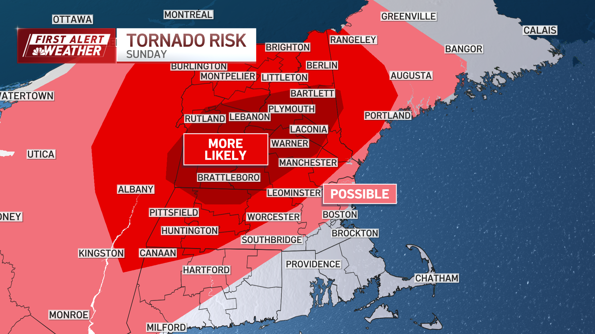
Sunday morning we’ll see warmer air surging back into coastal southern New England as well as Vermont, New Hampshire, and Maine as a warm front advances to the north.
The threat for a pop-up shower and storm remains in the forecast much of the day, but the main focus will be during the mid to late afternoon hours as a line of showers and thunderstorms develop and advance east, some of which could become strong to severe with hail, gusty wind, and localized flooding.

Temps will reach the mid to upper 80s across the south, 80s north, 60s and 70s central and northern Maine.
Have a great weekend!

