The Latest
-
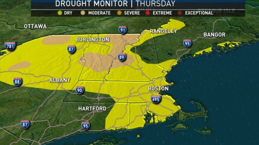
Dry, Mild Pattern Continues in New England
A very slow-moving weather pattern across North America and the North Atlantic Ocean has been benefitting New England much of this week, and while the benefits only increase through Saturday, it looks like this same slow motion weather progression will mean an extended period of showers next week. For now, each day has been progressively milder, with cooling sea breezes…
-
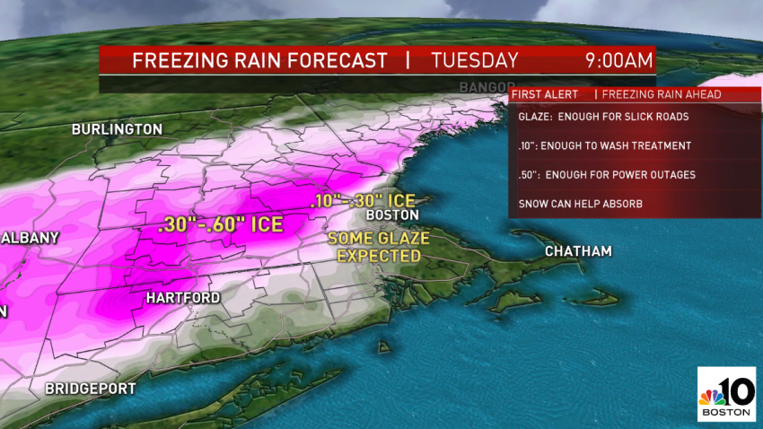
Messy Winter Weather This Week, Including Icy Mix Tonight
A slow-moving frontal system with multiple storm centers rippling along it over the past several days has left a path of destruction behind: multi-vehicle crashes in Fort Worth, TX, Friday, Nashville, TN, Saturday, Oklahoma City Sunday and from Alabama to Pennsylvania Monday morning. New England finds ourselves in the cross-hairs of this system Monday evening into Tuesday. Most of...
-
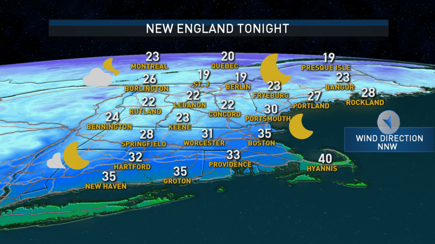
Colder Air Moves in Overnight into Sunday
Quick changes in air tend to bring waves of clouds from time to time, and that’s been the case for New England over the last couple of days, and is again today. This time around, the change in air is for the colder, with cooler air bleeding southeast across New England from Canada, arriving high in the sky first...
-
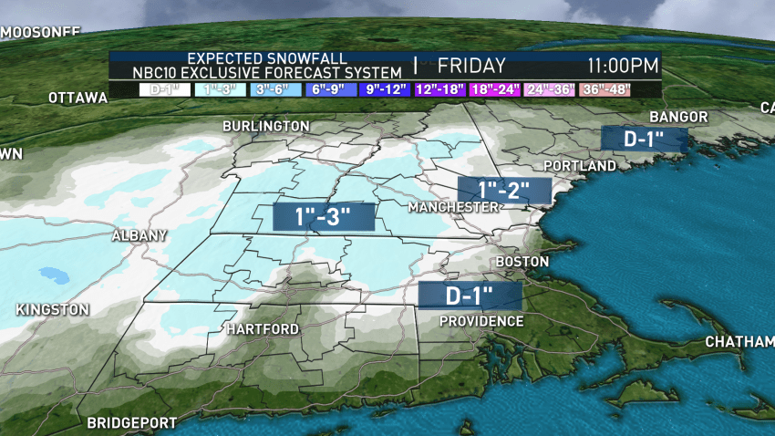
Storm to Deliver Plowable Snow to Parts of New England This Week
Our weather team has continued and expanded the First Alert for New England from 2 p.m. Thursday to 10 a.m. Friday for impactful rain, which is expected to change to snow for many overnight Thursday night into Friday morning. The setup is a complex one: Hurricane Zeta is charging north through the Gulf of Mexico, expected to make impact...
-
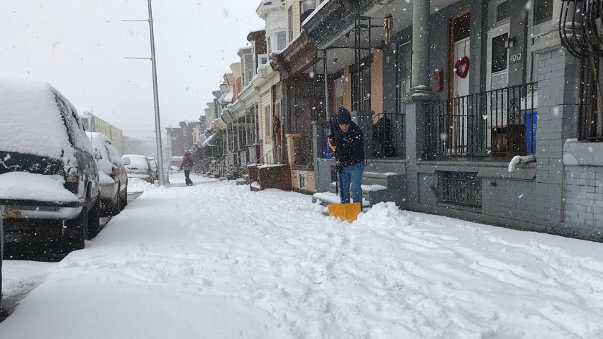
Storm Could Drop Up to 3 Inches of Snow on Parts of New England
Although the weather pattern is turning busier in the days ahead, New England will enjoy some quieter weather for a couple of days. A quick-moving and weak cold front Tuesday morning touched off a few sprinkles and light showers and reinforced cool air in New England. The cooler air is drier air, so some sunshine from late morning into...
-
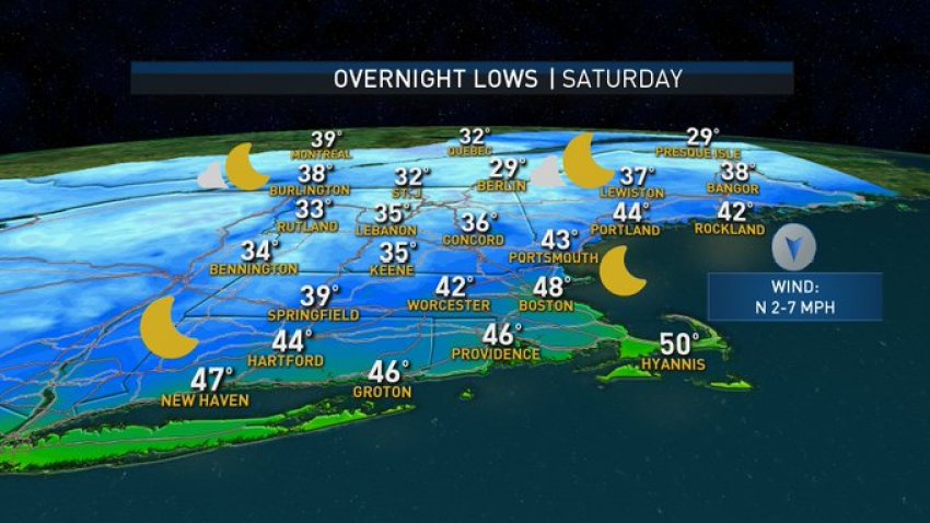
Cool Temperatures, Frost Sets In Across Region
In the middle of quiet weather for most of us, there’s still so much going on in the weather: drought, frost, and powerful waves from a hurricane to name a few. Starting with the drought, this week we received our weekly update from the government and university group that assesses drought across the country weekly, and our severe...
-
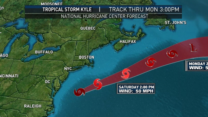
Winds from Tropical Storm Kyle Keep New England Cooler Saturday
New England is caught in a squeeze play between a high pressure, or fair weather, dome northeast of Maine and Tropical Storm Kyle to our southeast. In between those two systems a northeast wind will increase 10 to 20 mph steady today… With gusts over 30 mph at times! This onshore wind not only means that most of New England…
-
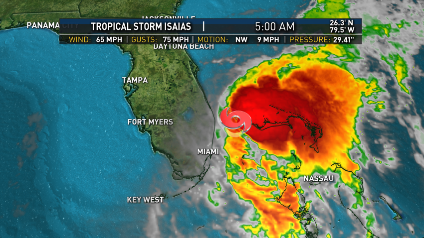
Tracking Isaias: What We Know and the Possible Impact on New England
Sunday dawns with pockets of clouds and fog that will burn off for a humid blend of sun and clouds, though an approaching disturbance Sunday afternoon and evening raises the chance of scattered showers and thunderstorms in Western New England – particularly Western Massachusetts through Connecticut. The combination of high temperatures in the 80s, dew point temperatures in the 70s…
-
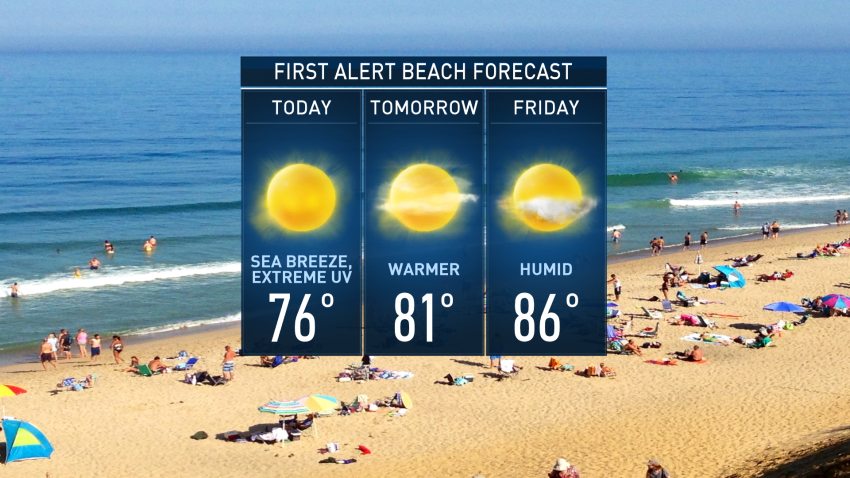
Keep the Sunscreen at the Ready: Incredible Stretch of Weather for New England
In an incredible stretch of weather for New England, there are still changes afoot that make each day of the next 10 a little different that the one before it. One thing that stays the same for a couple more days: an extreme ultraviolet index. Full sunshine so close to the strongest sun angle of the year for the Summer…
-
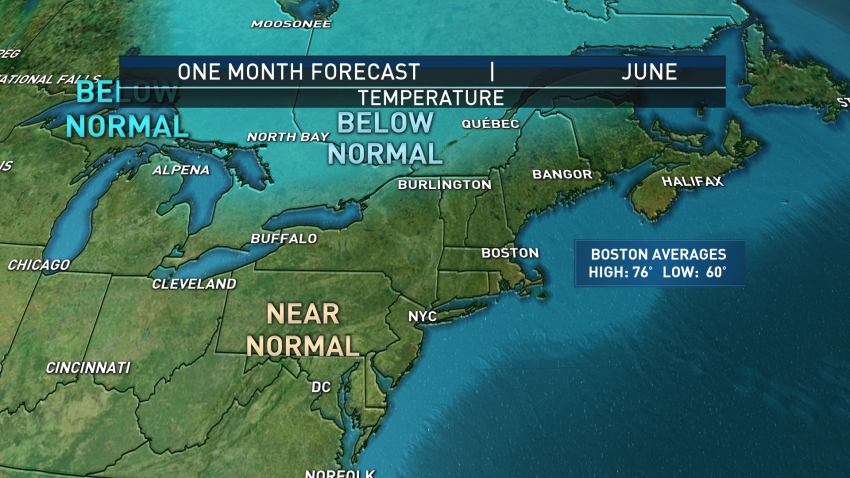
June Weather Outlook: Mostly Dry, Seasonable Temperatures
A day later than the usual first-weekday-of-the-month airing (due to the busy and difficult news day Monday), I shared my take on the month of June ahead. The weather pattern, overall, should be dominated by a large “ridge” – a broad dome of high pressure typically full of dry and warm air – over the central United States with a…

