Pete Bouchard joined the NBC 10 Boston and necn family in January of 2016, and broadcasts weekday evenings.
He’s been a familiar face to much of Southern New England over the past 13 years as the former senior meteorologist at WHDH in Boston.
Pete studied meteorology at one of first colleges in the country to offer a concentration in broadcast meteorology - Lyndon State College in Vermont.
His television career had humble roots in the basement of a motel in White River Junction, Vermont, where WNNE-TV was housed at the time. His next stops were WMTW in Portland, Maine, WVII in Bangor, Maine, WGME in Portland, Maine, and then on to Fox 25 in Boston.
The search for a television home didn’t end there though. He returned to Portland to work at Fox 51 with his wife as anchor before moving to WHDH in Boston in 2002.
All along the way, he gained experience across all of New England’s microclimates, visited countless schools (where some of the students went onto become interns of his), civic organizations and donated time to dozens of charities.
Pete has received numerous accolades in his long career from the Associated Press, Maine Association of Broadcasters, two Emmy nominations and three Best of Boston awards.
In his spare time, he embarrasses himself on the guitar and likes making sawdust in his workshop.
The Latest
-

How much will it snow this weekend? Storm's uncertain track will determine how much we get
As we move through this Thursday, enjoy the sun! Why, you ask? We’re tracking cloudy, cold weather on the way with a touch of a little snow into the weekend! Thursday, we’ll see a good deal of sunshine mixed with clouds. High temperatures will be in the mid 40s. Low temperatures will drop to near freezing overnight. Now, let’s talk about some...
-

Snowstorm pushing through Mass., half a foot already in some areas
We have a storm continuing to push through New England, bringing snow and rain — depending on where you are. Our weather team has everything you need to know. The rain and snow continue into mid-morning before sweeping quickly offshore Thursday. Our final round of weather will be some fast-moving squalls that pop up at random through midday. These will…
-

First significant snowfall expected for parts of Mass. this week
The weather pattern is both cold and wintry through the weekend. Our focus in the short-term is a vigorous weather system racing through early Thursday. We’ll see the precipitation break out Wednesday night after 10 p.m. With steady south winds blowing across the Commonwealth, towns and cities west of Bedford, Hopkinton, and north of Topsfield have the best chance...
-

First significant rain since September could hit later this week
It’s finally coming into view. Our first significant rain since late September looks like it will hit by Thursday as a developing storm sweeps into New England. Of course, now that I’ve committed to that, it probably won’t happen. That’s essentially how our weather has operated over the last few months. We see some signs of a break in...
-

‘Frightening' warmth: Halloween forecast looks downright balmy
Happy Halloween! To your ghoulish delight, there will be plenty of warm treats in the forecast. Highs creep up to the 80-degree mark in many towns and cities snapping records along the way while we maintain an eerie breeze from the southwest. Spooky clouds may dart in and out from time to time, but this a mostly bright finish to…
-

Monday kicks off with fog and gray skies — but a warmup is ahead
It’ll be heavy on the clouds in the next couple of days. While we’ll struggle to squeeze out any showers, onshore flow will keep the temperatures in check – especially along the coast – and the skies gray. After a somewhat murky start, highs on Monday should still manage to make it to 70 degrees in many spots, thanks to…
-

Record-setting dry spell will end with sizeable storm moving toward New England
The door closes on this near record-setting dry spell. We’re watching a sizeable storm elbow its way into New England Thursday. What looked like feeble attempt at showers is now looking like a more beneficial burst of rain for the area. Guidance seemed a bit timid about the idea of pushing this rain into a very dry area of...
-

Powerful geomagnetic storm brings northern lights as solar flare sends X-ray energy
Friday has been a historic night for space weather. We are in the midst of a G5 geomagnetic storm (the scale only goes to G5). This is the biggest geomagnetic storm since 2003, and in some respects, may be even bigger. Compounding this is that the active region of the Sun that produced this geomagnetic storm is also producing a…
-

Will the northern lights be visible in New England this weekend?
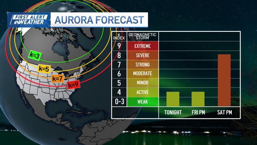
We’re on aurora watch this weekend in New England. Several bursts of magnetic energy, commonly referred to as coronal mass ejections (CME), were launched from the Sun’s surface and are now hurtling toward Earth. Some are moving slower than others and will be overtaken in route. The culmination of energy is expected to arrive by Saturday night and distort...
-

Breaking down Boston's great weekend weather
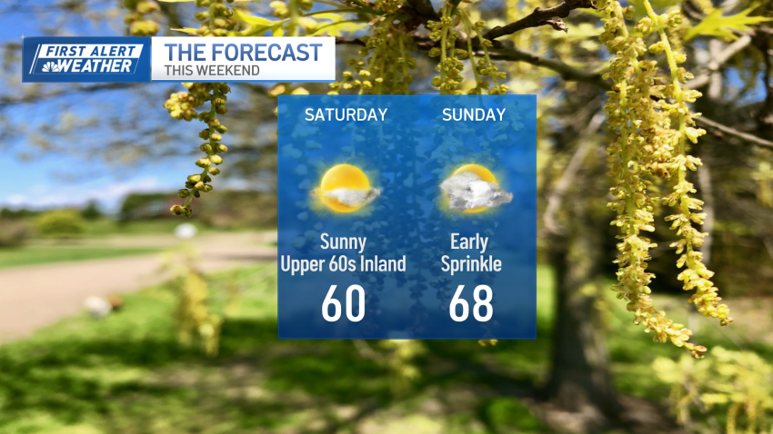
The weekend looks great – with a couple of minor strings attached. For one, the sea breeze is still around Saturday afternoon, cooling the coast and keeping us in the 50s. Second, there are a couple of showers that sweep through first thing Sunday morning. Although they’re minor – and likely not worth scrapping that tee time – they will…


