People are already talking about all the traffic expected Friday through Monday in Boston, between the 250th anniversary of Paul Revere’s midnight Ride from Boston to Lexington and the Boston Marathon.
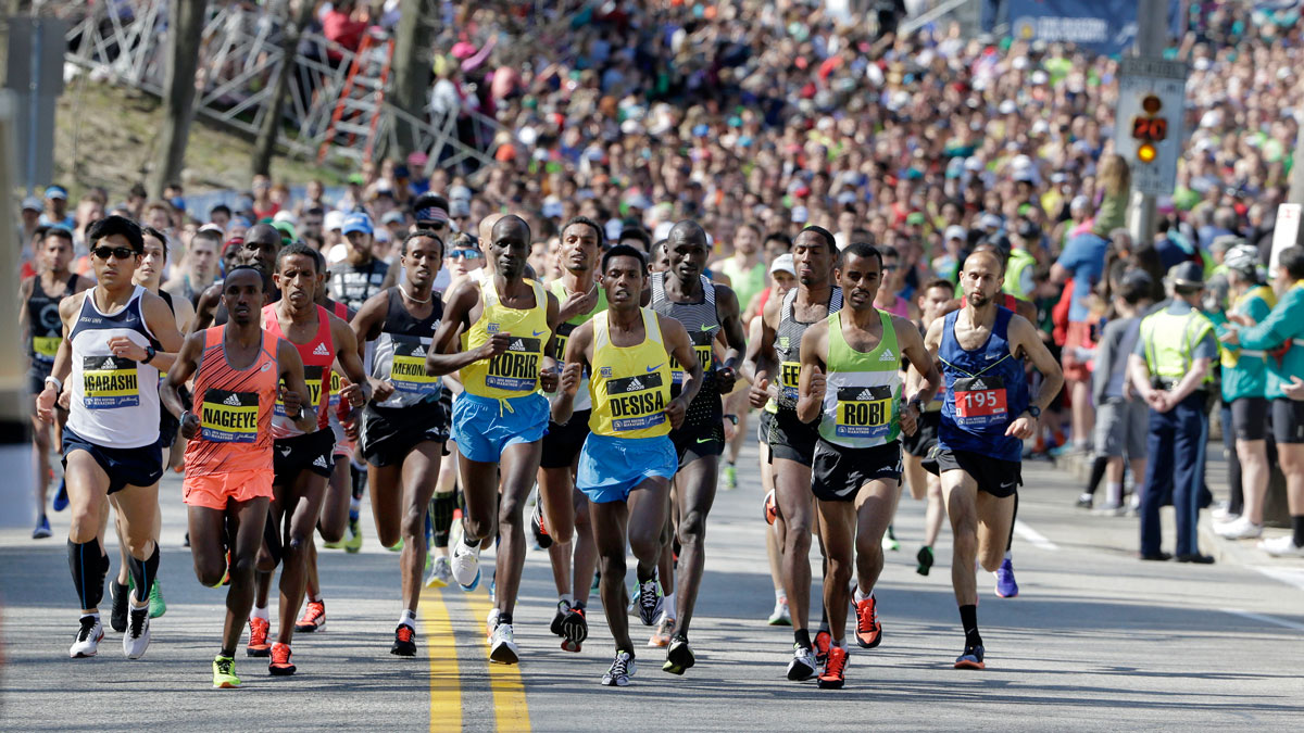
Anyone who's been in Boston on Marathon Monday knows that the biggest race of them all can cause some big traffic headaches.
The B.A.A. lists some of the traffic impacts on its website, including estimated times when the race will pass through, but leaves it to individual cities and towns to communicate specific closures.
Stream NBC10 Boston news for free, 24/7, wherever you are.
Don't drive, says John Kluse, a manager at North End institution Bova's Bakery. In fact, he says, "Don't even think about it." Use public transit instead.
Below, find each place's road closure announcement, from Hopkinton to Boston, with links where applicable.
Get updates on what's happening in Boston to your inbox with our News Headlines newsletter.
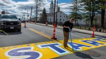
Hopkinton
Hopkinton Road Closures - On April 21st, roads immediately surrounding the start line and town common (Main St., Ash St., Park St, and Hayden Rowe) will close at 6:30am, followed by all other roads leading into the downtown area will be closed for general travel as of 7:00am. This year will be consistent with recent years prior. The major roads leading into the downtown area will be blocked at the following locations:
i. West Main Street at Lumber Street
ii. Wood Street at Elm Street
iii. Hayden Rowe Street at Chestnut
iv. Ash Street at Blueberry Lane
v. Cedar Street at Legacy Farms North
vi. East Main Street at every intersection
vii. In addition to these locations, all roadways that are adjacent to the roads where runners, spectators, volunteers, and workers are located will be blocked.
Ashland
Due to the Boston Marathon, Route 135 Eastbound and Westbound in Ashland will close at 7:15 am on Monday, April 21. No vehicular traffic will be allowed on Route 135 after 7:30. Cross traffic will be permitted until 8:30 am. After that time, the route will remain closed to all vehicular traffic until all the runners are through Ashland. Commuters and residents are urged to plan accordingly!
Framingham
Vehicular access to the marathon route (Waverly Street/Rt. 135) will be completed closed in Framingham from approximately 8:45am to 2pm. Many businesses in Downtown Framingham are open all day, though those along the route are only pedestrian accessible.
Wellesley
Roads close at 8:30 AM in Wellesley on Monday, April 21, 2025.
The Boston Marathon Route divides Wellesley in half. The race enters Wellesley on Central Street (Rt. 135) at the Natick line near Wellesley College. The race route proceeds east on Central Street through Wellesley Square. The race then continues on Washington Street (Rt. 16) eastbound through Wellesley Hills and into the Lower Falls. The race exits Wellesley on Washington Street at the Newton line.
The only way to cross over the route with a motor vehicle is to utilize Route 9 (Worcester Street) underneath Route 16 (Washington Street).
Live updates on road status or changes will be posted on X (Twitter) and Facebook on the day of the race under the Wellesley Police accounts.
The Boston Marathon requires significant road closures in Wellesley. Please note the following:
Central Street (Route 135) will be closed from the Natick line to Grove Street. Washington Street (Route 16) will be closed from Grove Street to the Newton line. There will be no traffic allowed across the race route once the road is closed. Vehicles parked in parking lots along the route will not be allowed to leave until the road is open. There are additional road closures in areas surrounding the Marathon Route for safety.
The roads will close at 8:30 AM on April 21 and remain closed until the end of the race. We expect to begin opening the roads at 3:30 PM. Please note this is an approximate time for opening.
YOU WILL NOT BE ABLE TO CROSS THE RACE ROUTE WITH A MOTOR VEHICLE ONCE THE ROAD IS CLOSED.
There will be some temporary ‘No Parking’ areas that will be posted close to the Boston Marathon Route. Vehicles that park in these temporary no parking zones will be towed and removed at owner’s expense.
Central Street, from Weston Road to Grove Street, and Washington Street, from Grove Street to Wellesley Avenue will have barricades in place on Sunday April 20, starting at 9:00 PM. No parking will be allowed on these sections of Washington Street and Central Street until the race has concluded the next day.
Some additional temporary no parking zones include:
Curve Street on the west side from Linden to Crest.
Crest Road on the west side from Linden to Curve.
Howe Street on the south side from Weston to Curve.
Weston Road on the east side from Linden to Turner.
Central Street from Weston to Grove
Linden Street from Weston Road to Crest Road on both sides of the road.
Wellesley Ave from Washington to Atwood
Woodlawn, near the DPW entrance
Garden Road one side to Colburn
Colburn Road one side
Chestnut Street one side
Washington Street on both sides from Grove to the Newton line.
River Street
Wareland Road
Brook Street from Wellesley Ave to Amherst Road.
Newton
On Monday, April 21st there will be multiple temporary road closures and traffic restrictions in effect due to the running of the 129th Boston Marathon. Roads along the marathon route—including Washington Street (Route 16), and Commonwealth Ave (Route 30)—will be closed to vehicle traffic starting at approximately 08:00 am in the morning and will remain closed until approximately 06:00 pm.
Brookline
Beacon Street will be closed to all vehicle traffic from 8 am until 6 pm, so please to plan accordingly. Crossing Beacon Street is limited for most of the day. The designated cross-points for pedestrians are the following:
BEACON @ TAPPAN
BEACON @ WEBSTER
BEACON @ HAWES
If you need to cross, be prepared to wait a while. These crossover locations are unavailable between 1pm and 3pm!
Boston
The city has a detailed page on street closures, parking impacts and more. Here are the parking restrictions for marathon weekend and the time around it:
No Stopping April 8 - 24
- Exeter Street (east side), from Boylston Street to Blagden Street
No Stopping April 9 - 24
- Blagden Street (south side, opposite side of library), from Huntington Avenue to Exeter Street
- Blagden Street (north side, library side), from the BPL Driveway to Exeter Street
- Boylston Street (both sides), from Exeter Street to Dartmouth Street
- Boylston Street heading easterly by Copley Square Mall from Dartmouth Street to Clarendon Street
No Stopping: APRIL 14 - 24
- Blagden Street (north side), Dartmouth Street to BPL Driveway
- FIREHOUSE ONLY: Hereford Street (both sides), Boylston Street to Public Alleys #443 & 444
No Stopping: April 16 - 22
- Exeter Street (west side), Alley 441 to Boylston Street
- B.A.A. VEHICLES ONLY: St. James Avenue to Stuart Street
No Stopping: FRIDAY, SATURDAY, MONDAY
- Beacon Street (south side, Boston Common side), from Charles Street to Joy Street
- Boylston Street (both sides), from Dalton Street to Dartmouth Street, unless otherwise posted
- Dartmouth Street (both sides), from Boylston Street to Commonwealth Avenue
- Exeter Street (both sides), from Newbury Street to Huntington Avenue, unless otherwise posted.
No Stopping: THURSDAY TO MONDAY
- Clarendon Street (both sides), from Newbury Street to Stuart Street
NO STOPPING: SATURDAY TO MONDAY
- Beacon Street, from Bay State Road to Brookline Town Line (both sides)
- Berkeley Street (both sides), from Stuart Street to Newbury Street
- Boylston Street (both sides), from Dartmouth Street to Charles Street, unless otherwise posted
- Cambridge Street (both sides), from Court Street to Sudbury Street
- Charles Street (both sides), from Boylston Street to Beacon Street
- Hereford Street (both sides), from Public Alleys #443 & 444 to Newbury Street
- Saint James Avenue (both sides), from Arlington Street to Dartmouth Street
- Stuart Street (both sides), from Huntington Avenue to Arlington Street
NO STOPPING SUNDAY & MONDAY
- Clarendon Street (both sides), from Public Alley 436 to Newbury Street
- Newbury Street (both sides), from #29 Newbury Street crossing over Berkeley Street to #69 Newbury Street
No Stopping Saturday 12:01 AM through 3:00 PM
- Bay State Road Street (both sides), from Beacon Street to Silber Way
- Clarendon Street (both sides), from Newbury Street to Boylston Street
- Newbury Street (both sides), from Dartmouth Street to Exeter Street
- Silber Way (both sides), from Bay State Road to Commonwealth Avenue
No Stopping: Monday
- Arlington Street (both sides), Beacon Street to Isabella Street
- Beacon Street, Brighton (both sides), Chestnut Hill Avenue to Brookline Line
- Beacon Street, Back Bay (South side, Public Garden side), Charles Street to Arlington Street
- Berkeley Street (both sides), Columbus Avenue to Commonwealth Avenue, unless otherwise posted
- Belvidere Street (both sides), Huntington Avenue to Massachusetts Avenue
- Boylston Street (both sides), Massachusetts Avenue to Dalton Street
- Cambria Street (both sides), Boylston Street to the loading dock of the Hynes Center
- Charles Street South (both sides), Park Plaza to Boylston Street
- Chestnut Hill Avenue (both sides), Commonwealth Avenue to Beacon Street
- Clarendon Street (both sides), Commonwealth Avenue to Columbus Avenue, unless otherwise posted
- Cleveland Circle (both sides, parking area adjacent to Cassidy Playground & parking area adjacent to Sutherland Road) from Beacon Street to Chestnut Hill Avenue, 24 hours
- Columbus Avenue (both sides), Arlington Street to Dartmouth Street
- Commonwealth Avenue (south, inbound, side), Beacon Street (Kenmore Square) to 80’ east of Hereford Street
- Commonwealth Avenue, Lake Street to Chestnut Hill Avenue (inbound)
- Dartmouth Street (both sides), Saint James Avenue to Columbus Avenue
- Deerfield Street (both sides), Commonwealth Avenue to Bay State Road
- East Dedham Street (both sides), Harrison Avenue to Albany Street
- Exeter Street (both sides), Commonwealth Avenue to Newbury Street
- Fairfield Street (both sides), Boylston Street to Commonwealth Avenue
- Gloucester Street (both sides), Commonwealth Avenue to Boylston Street
- Hereford Street (both sides), Commonwealth Avenue to Newbury Street
- Hanover Street (both sides, for Patriots' Day Parade), Tileston Street/Clark Street to Battery Street
- Kenmore Street (both sides), Newbury Street to Beacon Street
- Nassau Street (both sides, for Tufts Medical), from Washington Street to Harrison Avenue
- Newbury Street (both sides), Arlington Street to Brookline Avenue excluding the section already posted
- Plympton Street (both sides), Harrison Avenue to Albany Street
- Raleigh Street (both sides), Bay State Road to Beacon Street
- Stanhope Street (both sides), Berkeley Street to Clarendon Street
- Scotia Street (both sides), Dalton Street to St. Cecilia Street
- St. Cecilia Street (both sides), Belvidere Street to Boylston Street
- Washington Street (both sides, for Tufts Medical), from Oak Street to Nassau Street
- Washington Street (east side/even side), from Nassau Street to Kneeland Street
- Blagden Street (both sides), Huntington Avenue to Exeter Street, unless otherwise posted
- Bromfield Street (both sides, for Patriots' Day Parade) from Tremont Street to Washington Street
- Congress Street (north side, Faneuil Hall side) for Patriots' Day Parade, State Street to Hanover Street
- Commonwealth Avenue, Charlesgate West to Deerfield Street (outbound)
- Dalton Street (both sides), Boylston Street to Clearway Street
- Huntington Avenue (northwest side, odd side), Blagden Street to Massachusetts Avenue
- New Chardon Street (both sides), Merrimac Street to Cambridge Street
- Providence Street (both sides), Arlington Street to Berkeley Street
- State Street (both sides) for Patriots' Day Parade, Congress Street to Washington Street
- Tremont Street (both sides) for Patriots' Day Parade, Cambridge Street/Beacon Street to Stuart Street
- Washington Street (both sides) for Patriots' Day Parade, Bromfield Street to State Street
Family Meeting Area
- Clarendon Street
- Saint James Avenue
- Stuart Street
No Stopping: BAA Vehicles Only
- Trinity Place (west side, hotel side), St. James Avenue to Stuart Street