What a storm on this Saturday!
A coastal low strengthened fast offshore and to our south and swung in intense snowfall rates of 1-3” per hour this morning.
Stream NBC10 Boston news for free, 24/7, wherever you are.
Thundersnow also was heard across central Massachusetts with the intense snow bands over Worcester, Shrewsbury and in MetroWest.
Get updates on what's happening in Boston to your inbox with our News Headlines newsletter.
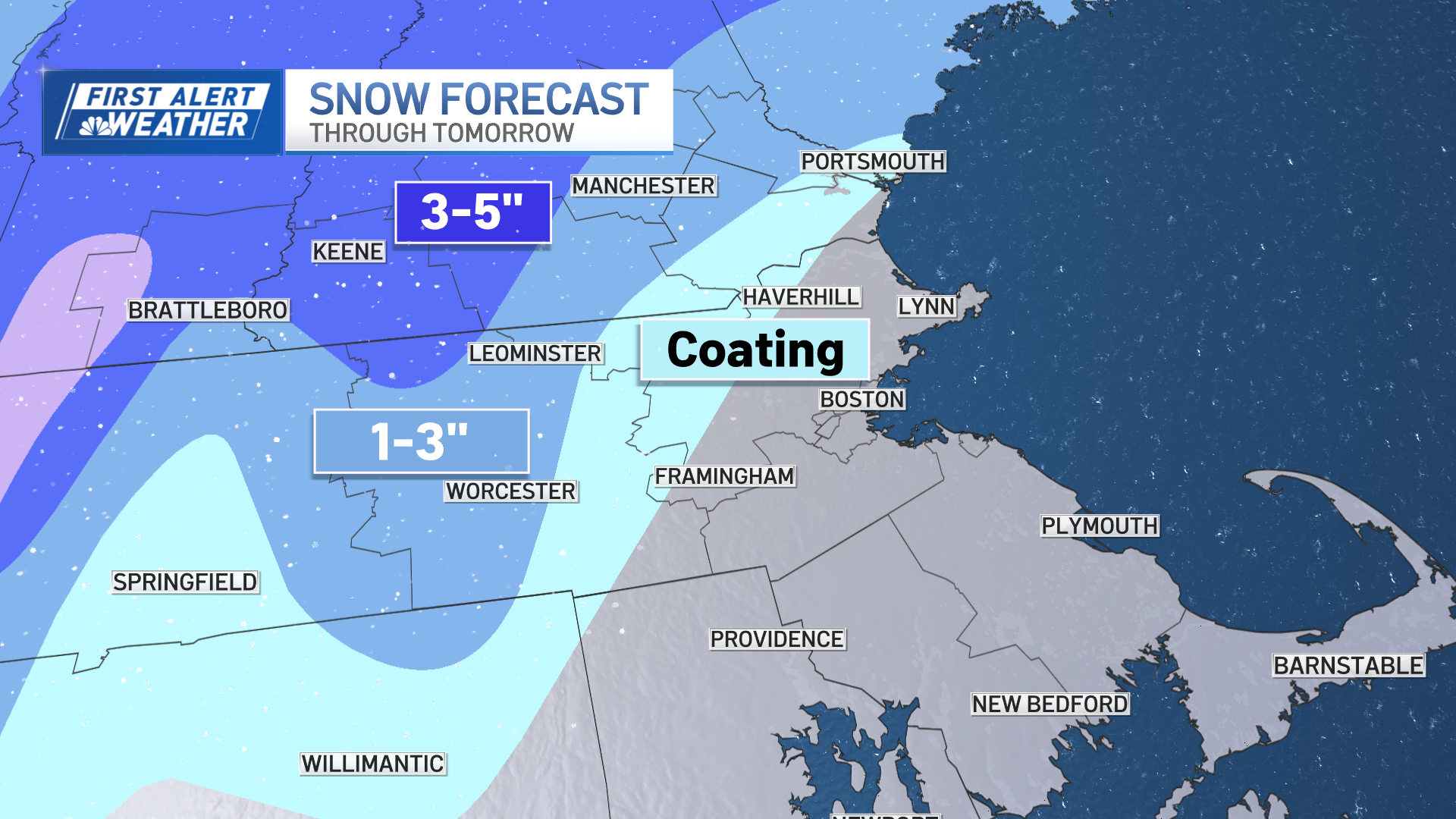
How much snow?
Higher elevations received 5-9" of snow across Worcester County, Massachusetts.
While Boston saw wet snowflakes, nothing stuck around once the sun came up.
It's a true springtime snow maker.
Snow will turn to rain
The snow changes to a mix by midday as the light snow and rain mix falls in the mountains of northern New England.
Drizzle, spotty showers linger all day and night in southern New England as that ocean storm heads towards the Gulf of Maine.

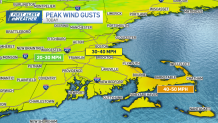
Strong winds persist
The northeast wind remains strong with gusts around 30 mph in Boston and 40-50 mph across the Cape & Islands.
While no coastal flooding is in the forecast, we will see some beach erosion from the increased waves.
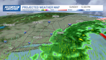
More rain this weekend
Sunday brings more rain to the eastern half of New England as the ocean storm is slow to move out. The wind is more from the north, with gusts around 30 mph through the day.
Temps stay in the low 40s with wind chills in the 30s. Another 0.5” to 1” of rain is possible through Sunday.
Western New England (Berkshires, Vermont, Connecticut) will actually see late day sun and a dry evening. While our weather in Boston does not improve…until Monday.
What's the weather next week?
Monday and Tuesday we see drier air, sun and warmer temps with highs in the 60s. A couple showers are possible for Tuesday, then we dry off again for Wednesday and Thursday.
Friday through Easter weekend next weekend looks again rainy at times. The timing and how much rainfall is still TBD. For now, the timing has changed since 24 hours ago. So it looks rainy for Saturday afternoon, and again Monday afternoon.