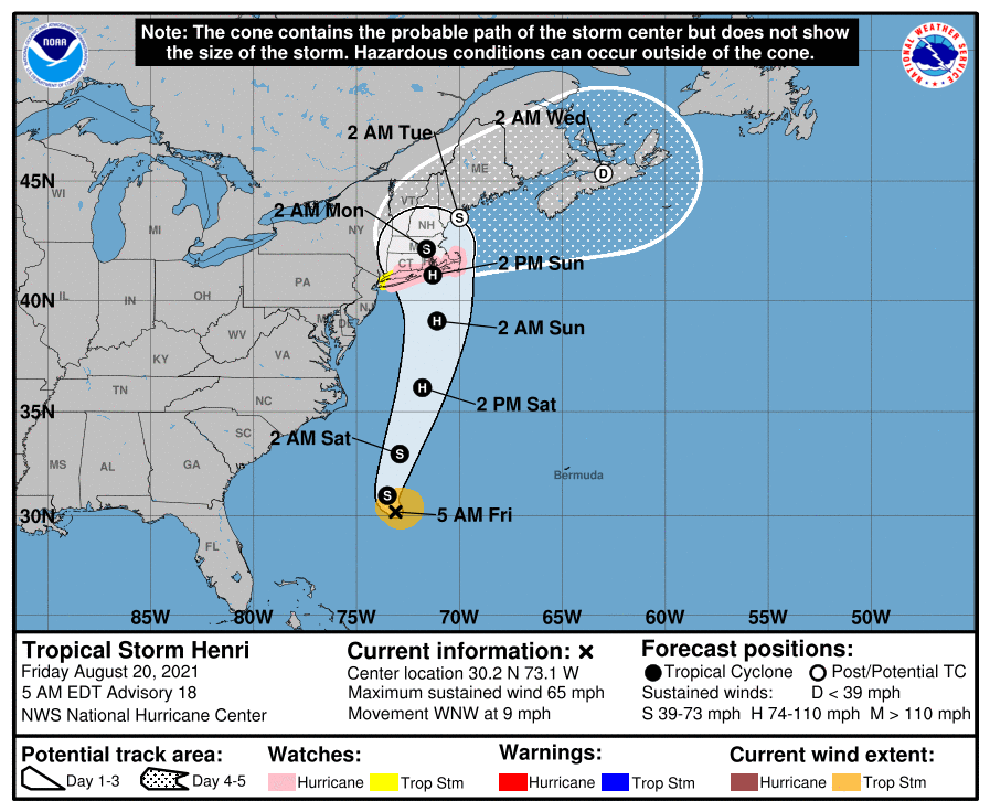
Henri has now been upgraded to a hurricane, meaning it will be the first hurricane to make landfall in New England in 30 years when it barrels into the region on Sunday.
The National Weather Service says that even though the rain may miss southeastern Massachusetts and Rhode Island, the strongest winds are centered east of the core, so these areas should still be prepared for impacts.
WATCH ANYTIME FOR FREE
>Stream NBC10 Boston news for free, 24/7, wherever you are. |
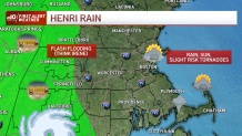
Rain and flooding are expected to be significant impacts of Henri, with more than 5 inches of rain expected to fall across Connecticut and western Massachusetts.
Get updates on what's happening in Boston to your inbox. Sign up for our >News Headlines newsletter.
The storm track has changed significantly in the past 24 hours. On Friday, the models plowed Henri right into eastern Massachusetts: straight through New Bedford, into Boston and exiting to the Gulf of Maine via Portsmouth, New Hampshire. While not a doomsday scenario with a Category 1 hurricane, it would have been every bit of Hurricane Bob in 1991.
Fast forward to Friday night, when three models curved the storm west and showed a direct hit in New York City by Sunday afternoon.
Clearly light years apart.
How could they be so wrong? Aren’t models getting better?
First off. This isn’t a simple nor’easter. The short answer is that tropical systems are steered by fickle winds. And they’re easily swayed in one direction or the other by shifts in those winds over time. Tacking a course in a certain direction doesn’t guarantee it will continue in that direction ad infinitum.
So the bottom line is we can stand down from direct effects of the hurricane (locally), and look for some sort or combination of storm surge, tropical rain bands, gusty (but rarely damaging wind) and sun.
Yeah. I said sun.
During a hurricane.
Our weather system responsible for the westward shift is a low pressure system over Pennsylvania. Picture this as the eddy in the stream. Henri is the leaf. The leaf circles the eddy, but doesn’t fall into the center. And that’s the simple metaphor for the circulation steering Henri. This low is tugging on Henri, but never really envelopes it. Eventually the eddy will expel the leaf and it floats downstream. That happens Monday, when Henri moves away as a much weaker tropical depression.

We’re not getting off scot-free however. There’s still the issue of rain bands, which could produce brief, intense rain and the slightest possibility of quick spin-up tornadoes. This happened with Fred, and it can and does happen far from the center of hurricanes and tropical storms.
There’s also the issue of storm surge, which is still on the docket across the Cape and Islands and any south-facing shoreline. Astronomically high tide isn’t helping matters either. We're expecting a surge of 3 to 5 feet in some spots.
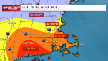
Gusts of wind will also be an issue. Some gusts could top 40 to 50 mph at times, predominantly at the water’s edge. Water-saturated soils could easily cause trees to uproot at those speeds, so some power outages are possible, although I’m not thinking they will be long-duration outings.

There’s still a lot of ground to cover and plenty of concerns in the next day. Check back often for updates, and keep those battery-operated devices charged.


