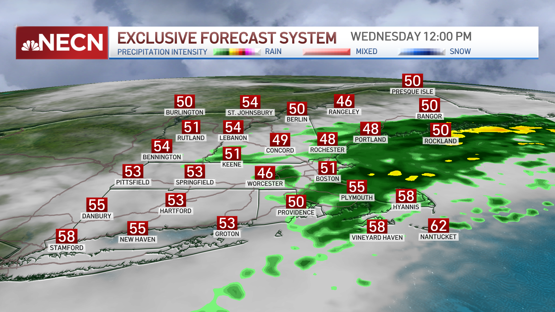
Wednesday: Wind-whipped rain. Highs 50 to 55. Northeast gusts slowly decrease from 60+ morning, but still 45+ mph late day. Overnight Wednesday: Light rain to drizzle, gusty wind. Lows in the 40s. Thursday: Sprinkles to late breaks of sun. Highs 50 to 55.
Our powerful nor’easter left hundreds of thousands without power in Massachusetts, widespread tree and power line damage and significant coastal flooding. The worst is found across southeast Massachusetts.
Wednesday afternoon, storm cleanup begins, but it will be extremely slow going. Power crews will not be able to get their bucket trucks deployed due to ongoing strong winds.
Stream NBC10 Boston news for free, 24/7, wherever you are.

Here's what you need to know over the next 24 hours:
Get updates on what's happening in Boston to your inbox with our News Headlines newsletter.
Wind
The highest wind for this storm was a 94 mph gust in Edgartown on Martha’s Vineyard at the Chappy Ferry dock at 4:31am. Seventy-five to 85 mph gusts were found all over the coastline overnight.
Winds remain damaging throughout the day in eastern Massachusetts, with gusts of 40 to 50 mph and up to 60 mph on Cape Cod. Overnight, gusts will be 40 mph and 50 mph on the Cape.
Thursday, we see peak winds of 30 mph, easing by the afternoon.

Rain
Showers continue off and on across eastern New England as the storm system slowly heads southeast. Our fresh water flood threat is over.
We have a break in storms Thursday, with some sun popping out.
Coastal flooding
Our bomb cyclone intensified rapidly overnight. The pressure on Nantucket dropped 28 mb in the last 24 hours, going from 1008 mb to 980 mb. The last bomb cyclone we saw was Oct. 17, 2019. The pressure dropped even more, with a record pressure off 977.4 mb at 5 a.m. That is an October pressure record for the island. The lower the pressure, the bigger the storm.
Winds intensified and pushed a wall of water our way. The buoy off Gloucester recorded a 32 foot wave height this morning. Twenty to 30 foot waves were just offshore all along the coast. This is the case for Wednesday afternoon's high tide cycle around 4 p.m. Minor to moderate flooding will occur in coastal Plymouth County and on the Cape. Major splash over and erosion will occur again. Rough seas of 10 to 15 feet will continue through the weekend.
What's next?
We will be chilly away from the coast Thursday night after a dry day. Another system brings in rain Friday night to Saturday. This one will not be as strong as this last storm.
Halloween is the pick of the weekend on Sunday, with morning showers tapering and mid 60s temperatures.
Quiet weather continues for the start of November.


