A wave of low pressure tracking through the region on Monday will provide us with a chilly and wet start to the work week. Periodic showers will be with us much of the day, with some moderate downpours possible across the South Coast of New England.

WATCH ANYTIME FOR FREE
Stream NBC10 Boston news for free, 24/7, wherever you are. |
Far northern Maine, New Hampshire, and the higher elevations of northern Vermont will be cold enough to see some snow. Though much of it will melt when it hits the ground, we’re expecting the best chance for accumulating snow across northern Maine, where several inches are expected.
Get updates on what's happening in Boston to your inbox. Sign up for our News Headlines newsletter.
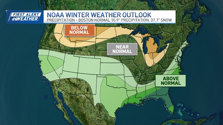
And don't look now, but even more snow could be on the way later this week and next week.
Highs on Monday will range from the 30s far north to the low 50s south, few low 60s along the southern New England coastline as you find yourself in the warm sector of the system. Showers will taper off overnight, with chilly and drier air settling in and sticking around through Tuesday and the midweek. Lows Monday night will dip into the 20s far north and 30s south.

Watch for some black ice early across the interior of central and northern New England on Tuesday morning. Halloween is looking dry and chilly, which is great news for the trick-or-treaters. Highs will top out in the upper 30s far north and the upper 40s to around 50 south with sunshine and a few clouds.

Wednesday we’ll be tracking more showers as a system passes off shore. With cold air in place, it wouldn’t surprise us if we saw a few wet snowflakes mixed in, especially across the interior, but not expecting any accumulation.
The rest of the week will feature a warming trend, with 60s returning by the weekend.