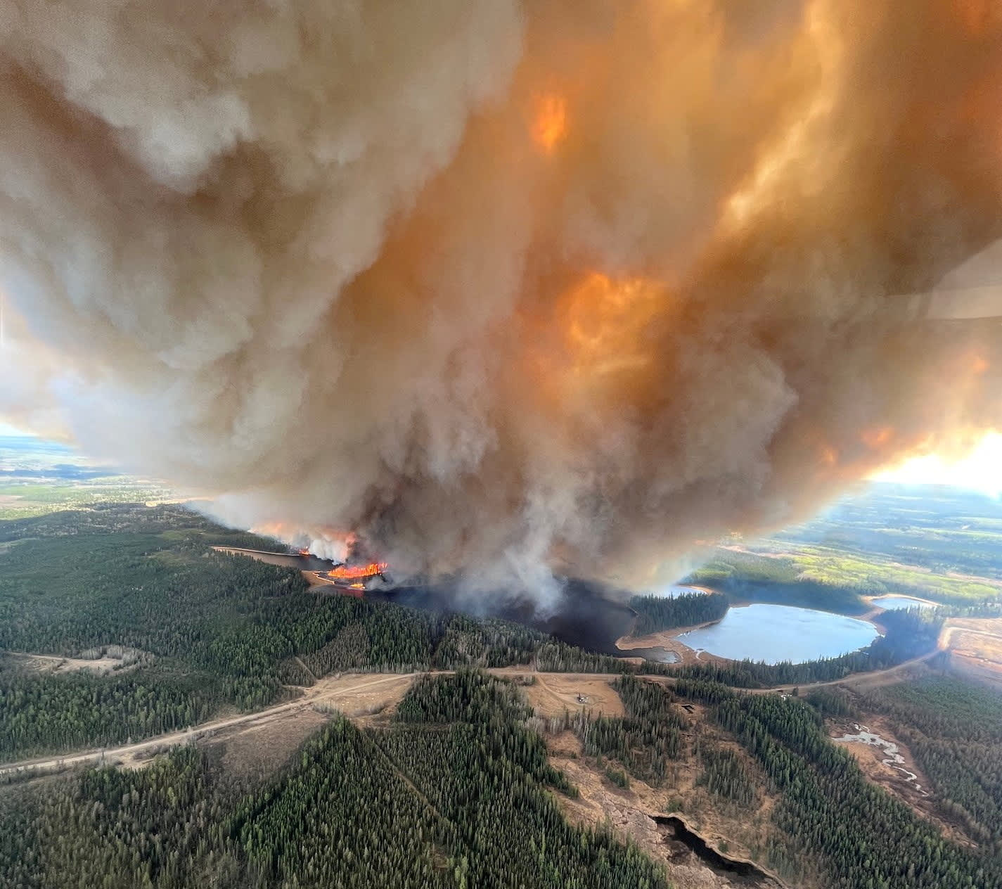
Wildfire smoke has been the headline over the last 24 hours and continues to be the biggest weather story Wednesday, as air quality has dipped to unhealthy levels for sensitive groups, owing to the smoke from wildfires that have been burning in Quebec.
This wildfire smoke actually has encompassed much of the eastern United States, driving air quality levels to unhealthy in places like Washington, D.C., and parts of North Carolina.
WATCH ANYTIME FOR FREE
>Stream NBC10 Boston news for free, 24/7, wherever you are. |
Living in sepia: Photos from NYC show thick wildfire smoke creating orange glow
When will air quality improve?
Get updates on what's happening in Boston to your inbox. Sign up for our >News Headlines newsletter.
Here at home, a fresher breeze should disperse the smoke to lighter content by later Wednesday, resulting in a gradual improvement of air quality for the Boston Metro and northeast New England, though smoke will remain dense in western New England.
Both the surface wind and the steering wind aloft driving the plumes of smoke are directly linked to a large, very slow storm that continues to be stalled over Nova Scotia. As bundles of energy wrap around the storm’s counter-clockwise flow of air, dropping south over New England, rounds of clouds and showers blossom in that atmospheric energy, which is why our First Alert Team expects morning sprinkles and afternoon scattered showers to continue as the theme Wednesday through Friday.

Chance of storms Friday
When enough difference between relatively warm surface air and cold sky air exists, as was the case Tuesday afternoon, thunder can develop within the showers, and we believe that possibility rises again Friday afternoon. Most New England communities will see daytime high temperatures in the 60s the rest of this week, though there will be exceptions: cooler exceptions in the cloudiest spots of northern New England and milder exceptions where the most sun is present in far southern New England.
What's in store this weekend?
The weekend brings improvement as the slow-moving storm over Atlantic Canada drifts east, so while a pop-up shower can’t be ruled out Saturday, most of the day should be enjoyable for New England with highs rebounding to either side of 70° and a blend of sun and clouds, then fantastic weather is expected Sunday as highs reach the 70s! Although not expected to be over Nova Scotia, a similarly slow-moving storm at the surface and aloft is expected to near the Northeastern U.S. early next week, raising the chance of showers in our exclusive First Alert 10-day forecast for Monday through Wednesday – we’ll continue to fine tune details as we get closer.


