


Life-threatening storm surges are expected to hit Florida's Gulf Coast this week with Hurricane Milton, which was upgraded Monday afternoon to a Category 5 storm over the southern Gulf of Mexico.
The storm first strengthened into a Category 3 hurricane by 7 a.m., and, by 9 a.m. ET, it had rapidly grown to Category 4, the National Hurricane Center said.
WATCH ANYTIME FOR FREE
Stream NBC10 Boston news for free, 24/7, wherever you are. |

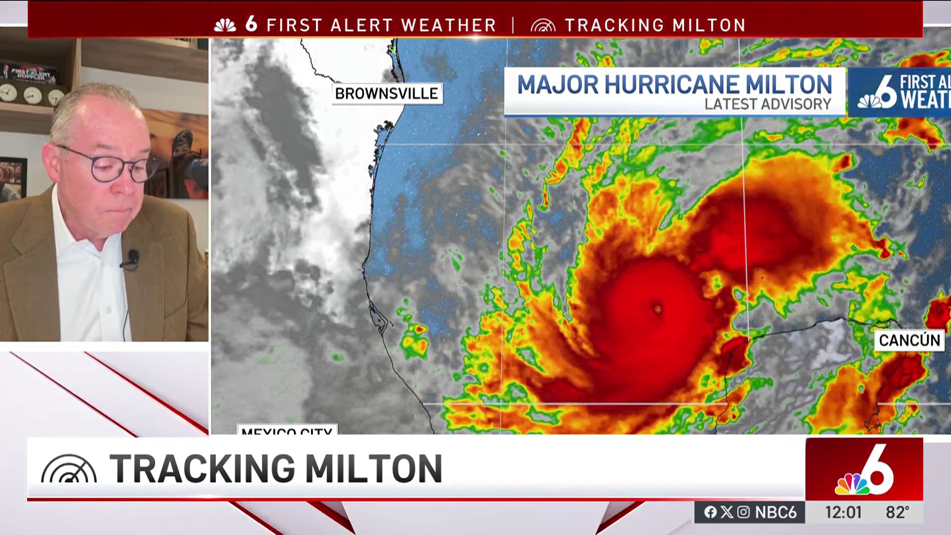
In a matter of a few hours, Milton "explosively intensified" into a Category 5 hurricane. Milton now churns with fierce 180-mph winds, the NHC said in a 4 p.m. ET update. It's about 105 miles west-northwest of Progreso, Mexico, and 700 miles southwest of Tampa.
The storm is forecast to make landfall Wednesday evening in Florida, which, along with the wider Southeastern U.S., continues to recover from the impact of Hurricane Helene. Widespread evacuation orders are in effect in Florida.
Get updates on what's happening in Boston to your inbox. Sign up for our News Headlines newsletter.
As many as 15 million people are under flood watches across the Florida Peninsula, and 11 million are at risk for tropical tornadoes Tuesday and Wednesday.
Follow along for live coverage
By key measures, Milton is shaping up to be one of the most powerful Atlantic hurricanes on record, and it has s done so in an astonishingly short amount of time, evolving from Tropical Depression 14 to a Category 5 hurricane in less than three days.
Its low-pressure readings — the lower the number, the more potent the storm — are among the 10 lowest on record, and its wind speeds are the highest recorded for an Atlantic storm this late in a season, Colorado State University meteorologist Phil Klotzbach said.
"Milton is the strongest hurricane in the Gulf of Mexico by either wind or pressure since Hurricane Rita in 2005," he said by email.
Rita, which raged in late September of that year, is the strongest hurricane ever recorded in the Gulf, according to the National Weather Service.
"Over the next few days, Tampa Bay is faced with the biggest hurricane it’s had in more than 100 years," Pinellas County's Cathie Perkins, director of a regional emergency management agency, said at a news conference Monday. "This is serious."
Milton’s greatest risk is storm surge. While it’s not clear yet exactly where the center of the hurricane will make landfall, the worst surge will be just south of the center, and places could get 8- to 12-foot storm surges.
The hurricane center issued a storm surge warning early Monday for Florida's Gulf Coast from Flamingo on the southern tip to the mouth of the Suwannee River, including Tampa Bay. A hurricane watch is in effect along the same coastline, from Chokoloskee near Everglades City to the Suwannee River and Lake Okeechobee, while a tropical storm watch is in effect farther west to Indian Pass.
"A Storm Surge Watch means there is a possibility of life-threatening inundation, from rising water moving inland from the coastline," the agency said.
Milton will also dump more rain, including up to 15 inches across parts of the Florida Peninsula and Keys through Wednesday night, making flash flooding likely.
The Mexican government has issued a hurricane warning for the Yucatan Peninsula coast from Celestún to Rio Lagartos.
Florida Gov. Ron DeSantis said Monday that an around-the-clock operation to clear debris and fallen trees from Helene was underway ahead of Milton's arrival to minimize the threat from flying objects. He said Milton is expected to make landfall in Hillsborough or Pinellas County on Wednesday evening, and he pre-emptively issued emergency declarations for 51 counties.
Pinellas County, which occupies the Tampa Bay peninsula and its Atlantic-facing coast, has begun mandatory evacuations, according to a sheriff’s notice.
County Sheriff Bob Gualtieri said Monday’s that the evacuations cover a half-million people — a majority of the county’s population.
Hillsborough County issued a mandatory evacuation order for Evacuation Zones A and B, for all mobile homes and for manufactured housing starting at 2:30 p.m. Monday. Those residents should be in safe locations by 7 a.m. Wednesday. Nine shelters will be opened in mandatory evacuation zones.
Sarasota County also called for those in levels A and B (which includes barrier islands) and those in mobile or manufactured homes to evacuate Monday. Those living in level C “should be prepared to evacuate if the storm intensifies.”
In the coastal city of Anna Maria, south of Tampa, a mandatory order started midday.
Tolls have been suspended in West and Central Florida to facilitate evacuations out of the storm’s path.
For a list of all Florida evacuation orders click here.
However, state officials stress that people can leave without an order.
“Have a plan, execute the plan,” DeSantis said Sunday. “You certainly can leave now. You don’t have to wait to get an evacuation order.”
Polk County, to the east of Tampa, has published a list of shelters, including three pet-friendly ones.
Milton is noteworthy for its explosive growth and very unusual path, approaching Florida from the west: Since 1850, only two storms have originated in the Gulf's Bay of Campeche and made landfall in Florida.
Furthermore, for the first time on record, the Atlantic has three hurricanes simultaneously after September: Kirk, Leslie and Milton.
Milton's winds, which reached 180 mph Monday, are the strongest for an Atlantic hurricane recorded this late in a season, Klotzbach of Colorado State said on X.


The season runs June 1 through Nov. 30. Only two other Atlantic hurricanes have posted 180 mph winds or greater since 1950, Allen (1980) and Rita (2005), the professor said on X.
Milton is following Hurricane Helene, which brushed by the Tampa Bay region on its way north to landfall in Florida's Big Bend region Sept. 26. It killed more than 230 people in six states.
Perkins, director of the Pinellas County Emergency Management Department, said Milton could be twice as destructive for Tampa Bay. The last time the region sustained a direct hit from a hurricane was 1921.
"We already had a deadly brush with Helene," she said, "and Milton is projected to bring ... twice the impact from Helene."
This "will be a hurricane season that none of us will forget," chair of Pinellas County Commissioners Kathleen Peters said at the news conference. "Be safe, move quickly, and take care of your family."
Record-warm waters made more likely by climate change will fuel the rapid intensification of Milton as water in the Gulf of Mexico is 2-4 degrees Fahrenheit above average. Rapidly intensifying hurricanes are becoming more common in the warmer world.
Christine Rapp and Kathryn Prociv contributed.
This article first appeared on NBCNews.com. Read more from NBC News here:
