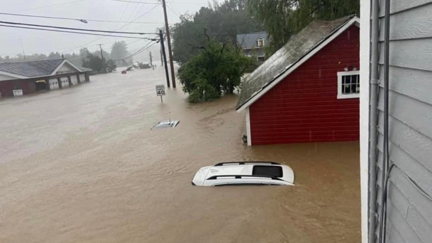
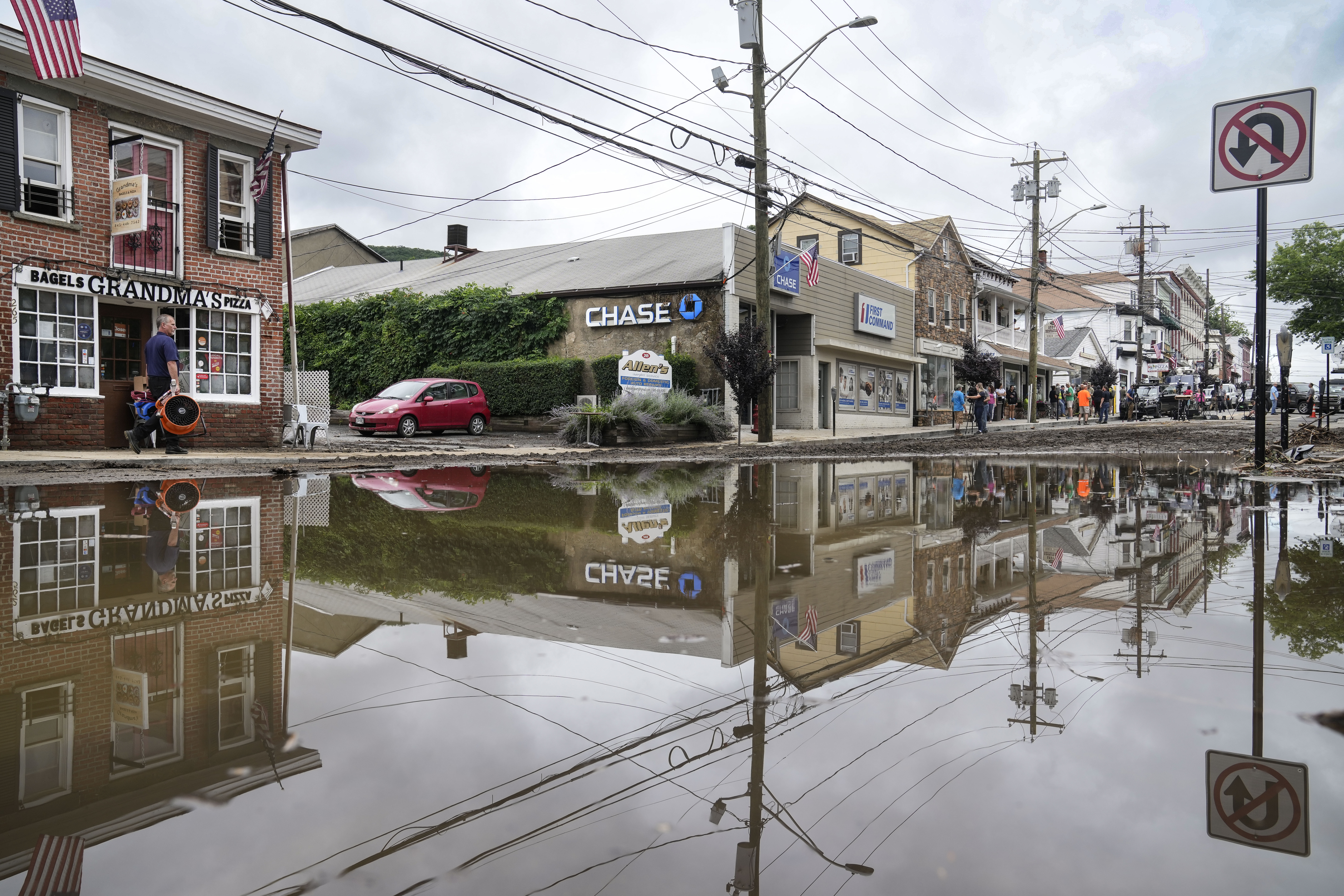
The rain has let up on Vermont but the flood emergency remained on Tuesday, with the partially submerged state capital in an emergency as a nearby dam was at risk of being overtopped.
Federal help is headed to Vermont amid the historic flooding after President Joe Biden approved an emergency declaration while on a trip to Lithuania, allowing FEMA to support the state as flooding concerns continue.
WATCH ANYTIME FOR FREE
>Stream NBC10 Boston news for free, 24/7, wherever you are. |
Vermont has seen remarkable rainfall — one area saw more than 9 inches fall — in a weather event being compared to Tropical Storm Irene in 2011 that prompted Gov. Phil Scott to issue a state of emergency on Monday.
Get updates on what's happening in Boston to your inbox. Sign up for our >News Headlines newsletter.
"Make no mistake, the devastation and flooding we are experiencing across Vermont is historic and catastrophic," Scott said at a news conference Tuesday.
"The good news is the rain has stopped in some areas but that does not mean waters may immediately recede. They may in fact continue to rise," said Scott, who had to hike from his home to a passable road on Tuesday morning.
The governor said that waters were still rising in some areas, such as Montpelier, where the Wrightsville Dam neared storage capacity.
"This has never happened since the dam was built so there is no precedent for potential damage. There would be a large amount of water coming into Montpelier which would drastically add to the existing flood damage," The city said in a Facebook post early Tuesday.
The city and Montpelier police monitored the situation all day, noting that at around 11:30 a.m. waters were just one foot from spilling over the dam. At about 1:45 p.m., water levels were holding, but officials still urged residents to keep away if possible for the active emergency situation — emergency services had been relocated to Berlin, Vermont, to ensure they would continue to operate in case of further flooding.
Streets near the Capitol remained inundated Tuesday afternoon. Some people took to using kayaks and paddleboards to get around.
"Seeing kayakers down Main Street in Montpelier is a pretty wild sight," resident Scott Cherhoniak said.
Scott said the focus of crews remained life and safety, and that thousands of Vermonters had lost homes, businesses and more.
Officials with the Vermont Agency of Transportation said that there were 78 state roads closed Tuesday, an increase from Monday's 24. The state's Urban Search and Rescue team said there had been 117 rescues and 67 plus evacuations performed so far.
Photos around the state showed rivers swelling to near-record levels, roads being washed out and cars almost completely submerged.
Flood warnings were in effect still on Tuesday morning in three Vermont counties.
Montpelier officials warn of potential for unprecedented damage
Early Tuesday morning, city officials in Vermont's capital, Montpelier, warned of a "potentially dangerous situation," saying that the Wrightsville Dam has 6 feet of capacity left. City Manager William Fraser wrote in a news release that if the capacity is reached, water will spill into the North Branch River, which would send even more water into the city.
"There would be a large amount of water coming into Montpelier which would drastically add to the existing flood damage," Fraser wrote. "This will be particularly bad along the North Branch River corridor and into the downtown. Unfortunately, there are very few evacuation options remaining. People in at risk areas may wish to go to upper floors in their houses."
Montpelier has requested water rescue assets to be moved into the area, and was also moving its dispatch center to the Water Treatment Plant.
"Once the waters recede we are going to have to do inspections on all of these buildings to see where electrical systems are and heating systems, there is going to be huge contamination, oil from boilers, that kind of thing its going to be a while before things can reopen," he added in an interview.
Montpelier had largely been spared during Tropical Storm Irene.
“For us, this is far worse than Irene. We got water but it went up and down. There were some basements flooded but it didn’t last long,” Fraser said, comparing this flooding to the Montpelier Ice Jams in 1992. “We are completely inundated. The water is way, way higher than it ever got during Irene.”
During Irene, Vermont got 11 inches of rain in 24 hours. Irene killed six in the state, washed homes off their foundations and damaged or destroyed more than 200 bridges and 500 miles of highway.
The U.S Army Corps of Engineers had also said late Monday that they expected the Ball Mountain Dam in Jamaica and the Townshend Dam in Townshend/Windham to release "unprecedented quantities of water over their spillways," causing “severe flooding” downstream likely to affect multiple towns.
But in an update Tuesday morning, they said they no loner expect the two dams to release large amounts of water over the spillways in the next 48 hours. Water will still be released from the dams, but in smaller than expected amounts.
Over 100 people rescued from rising waters
There have been no reports of injuries or deaths related to the latest flooding in Vermont, according to state emergency officials. There was one report of a person who was swept away by flood waters in Londonderry, but that report has not been confirmed.
Swift water rescue teams in Vermont have done more than 100 rescues, mainly in the southern and central areas of the state, Vermont Emergency Management said Tuesday.
Some people canoed their way to the Cavendish Baptist Church in Vermont, which had turned into a shelter. About 30 people waited it out, some of them making cookies for firefighters who were working to evacuate and rescue others.
“People are doing OK. It’s just stressful,” shelter volunteer Amanda Gross said.
Officials said on Monday that Londonderry, Ludlow and Weston were among the hardest-hit communities. But by Tuesday morning the flooding had made its way to the central part of the state.
"This is going to be a very long-term search and rescue operation, I expect it to take several days or longer," - Mike Cannon of Vermont’s Urban Search and Rescue team said.
Vermont Rep. Kelly Pajala said she and about half dozen others had to evacuate early Monday from a four-unit apartment building on the West River in Londonderry.
“The river was at our doorstep,” said Pajala. “We threw some dry clothes and our cats into the car and drove to higher ground.”
List of Vermont road closures
Dozens of roads are closed across the state as a result of the flooding. You can see an updated list here.
Among the buildings flooded Monday was the Weston Playhouse in Weston, Vermont, which had been performing “Buddy -- The Buddy Holly Story” to sold-out audiences.
The Weston Theater Company’s executive artistic director Susanna Gellert said the call was made at around 4 a.m. to evacuate 11 people associated with the production to higher ground and another 15 in nearby Ludlow. The three-floor playhouse, which had been damaged during Irene, was also flooded, with the dressing room and props room under water.
“As a theater, we were just starting to get back from the COVID shutdown,” Gellert said. “To have this happen right now is painfully heartbreaking.”
Cara Philbin, 37, of Ludlow, Vermont, was awakened by a neighbor early Monday and told to clear out of her second-floor apartment because the parking lot was already flooded.
“He told me me, ‘You need to get out of here ... your car is going to float away, and I suggest you do not stay,’” said Philbin. The neighbor took her car keys and moved her car to a higher spot, while she called her parents and then drove to their home to ride out the storm, she said.
Ross Andrews and his wife were driving back home to Calais, Vermont, on Monday when he saw trucks parked at a 230-year-old dam with crews trying to keep it from failing. There were trees down everywhere.
“The interstate was closed right at our exit. Our road was closed right at our driveway. We managed to thread our way back just in the nick of time,” he said.
Flood waters also impacting other parts of New England
The slow-moving storm reached New England on Monday morning after hitting parts of New York and Connecticut on Sunday. Additional downpours in the region raised the potential for flash flooding; rainfall in certain parts of Vermont had exceeded 7 inches, the National Weather Service in Burlington said.
Massachusetts Gov. Maura Healey said there were reports of flooding in central and western Massachusetts and that state emergency management officials were in touch with local authorities.
Flooding was also being reported in some areas of New Hampshire, though not to the extent that Vermont is experiencing. Goshen, Hillsboro, Marlow, North Walpole, Swanzey, Winchester and Windham were among the towns reporting damage.
Parts of Rhode Island experienced flooding Monday as well. WJAR said some areas of Cranston and West Warwick were impacted by the severe weather. Several people were displaced from their apartments and at least one water rescue was reported.
The Associated Press contributed to this report.


