As we await this weekend's winter storm, one factor could play a big role in whether the Boston area gets blanketed in fresh snow or a slushy mess: the path the storm takes.
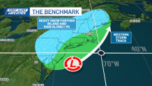
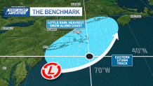
The Benchmark is a latitude-longitude boundary roughly 115 miles south of the Outer Cape that tends to determine the precipitation type of winter storms along the I-95 corridor.
STAY IN THE KNOW
Watch NBC10 Boston news for free, 24/7, wherever you are. |
|
Get Boston local news, weather forecasts, lifestyle and entertainment stories to your inbox. Sign up for NBC Boston’s newsletters. |
A Benchmark storm, which travels over 40°N, 70°W, typically brings a blockbuster nor’easter through much of the I-95 corridor. These types of storms have adequate cold air throughout their life cycle to produce big snow.
Get top local stories in Boston delivered to you every morning. Sign up for NBC Boston's News Headlines newsletter.
An outside runner storm tracks east of the 40/70 benchmark. These storms are glancing blows — they generally don’t bring all of New England a widespread heavy snow. Instead, most of the powder sticks along the immediate coastline, with little snow, if any, inland.
Inside runners that travel north and west of the demarcation take in warmer air. These storms are trickier because there’s usually a rain/snow line that sets up across southern New England. You then have to take into account how far inland the ocean temperature’s influence typically is.
This produces a tighter snowfall gradient where values along the coast are lower, and a short distance away from the coast can bring much heavier snow, thus higher totals.
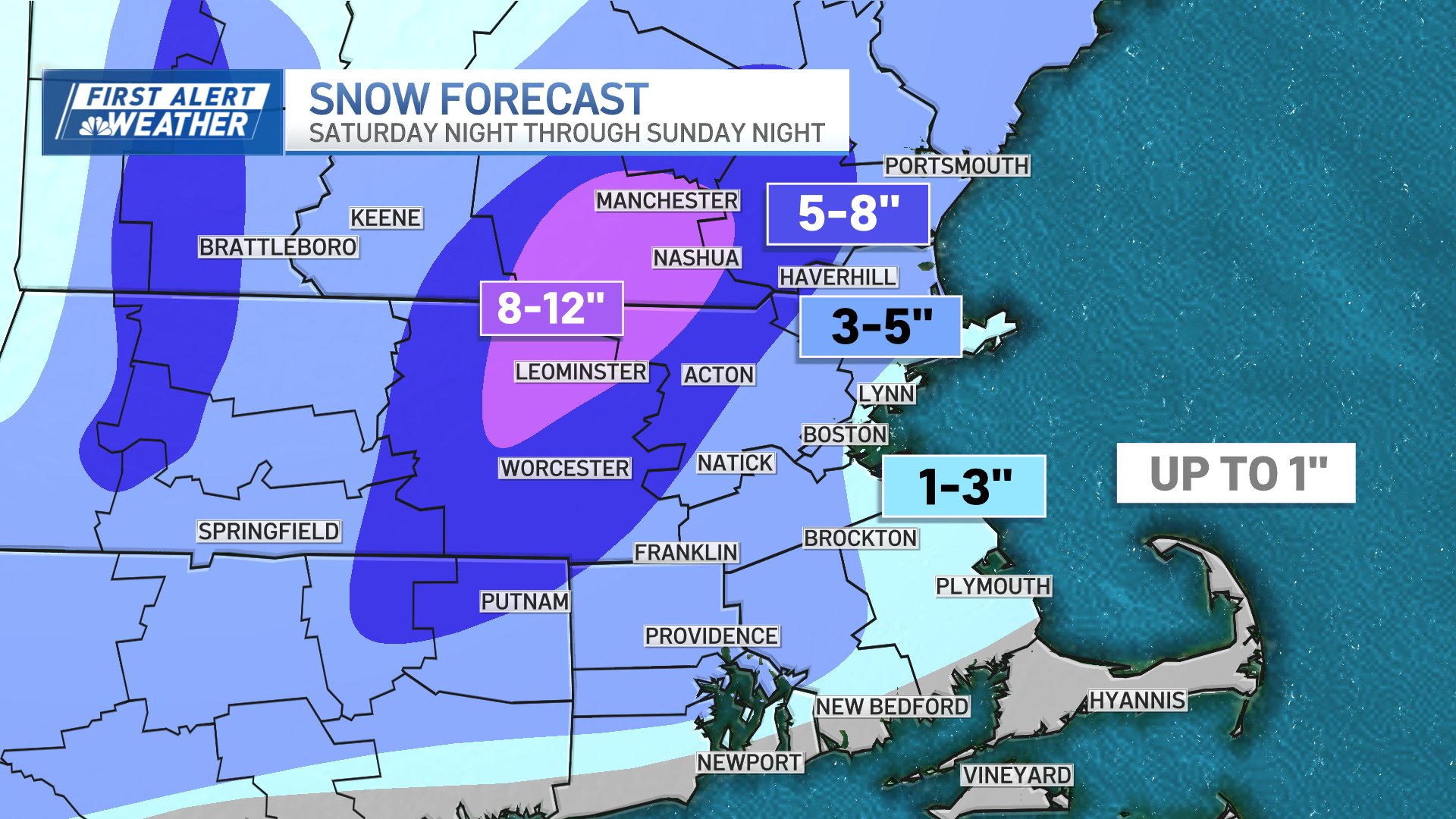
Sunday’s storm is, so far, looking to be an inside runner, with a rain-snow mix across I-93, and further to the south coast. It’s not out of the possibility that Boston’s snow is mixed with rain too.
More on the looming storm
Here are the latest snow maps for the Greater Boston area and the rest of New England