
Precipitation is coming Monday morning, though not right away, and for most of Greater Boston where snow does fall, it’s just a nuisance.
The airmass over New England has changed dramatically this Sunday.
A cold front Saturday night and strong northwest winds have opened the door to cool and dry air. We have an elevated brush fire risk Sunday with humidity levels around 20% and the strong wind.
WATCH ANYTIME FOR FREE
Stream NBC10 Boston news for free, 24/7, wherever you are. |

Highs stay in the mid 40s even with Sunday sunshine, thanks to the gusty wind. Wind chills stay in the 20s to 30s across New England with a wind subsiding to near calm after sunset.
Get updates on what's happening in Boston to your inbox. Sign up for our News Headlines newsletter.
Speaking of sunsets, Boston has its first 7 p.m. sunset tonight!
Monday morning brings us a chance for a wintry mix, light snow and then rain
More cold air is in place as this snow moves into the Northeast before dawn.
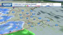
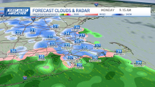
A quick chance for snow accumulation will be possible for areas around Interstate 495 in Massachusetts, around Boston we see some wet snowflakes, we change to rain by late morning.
Weather
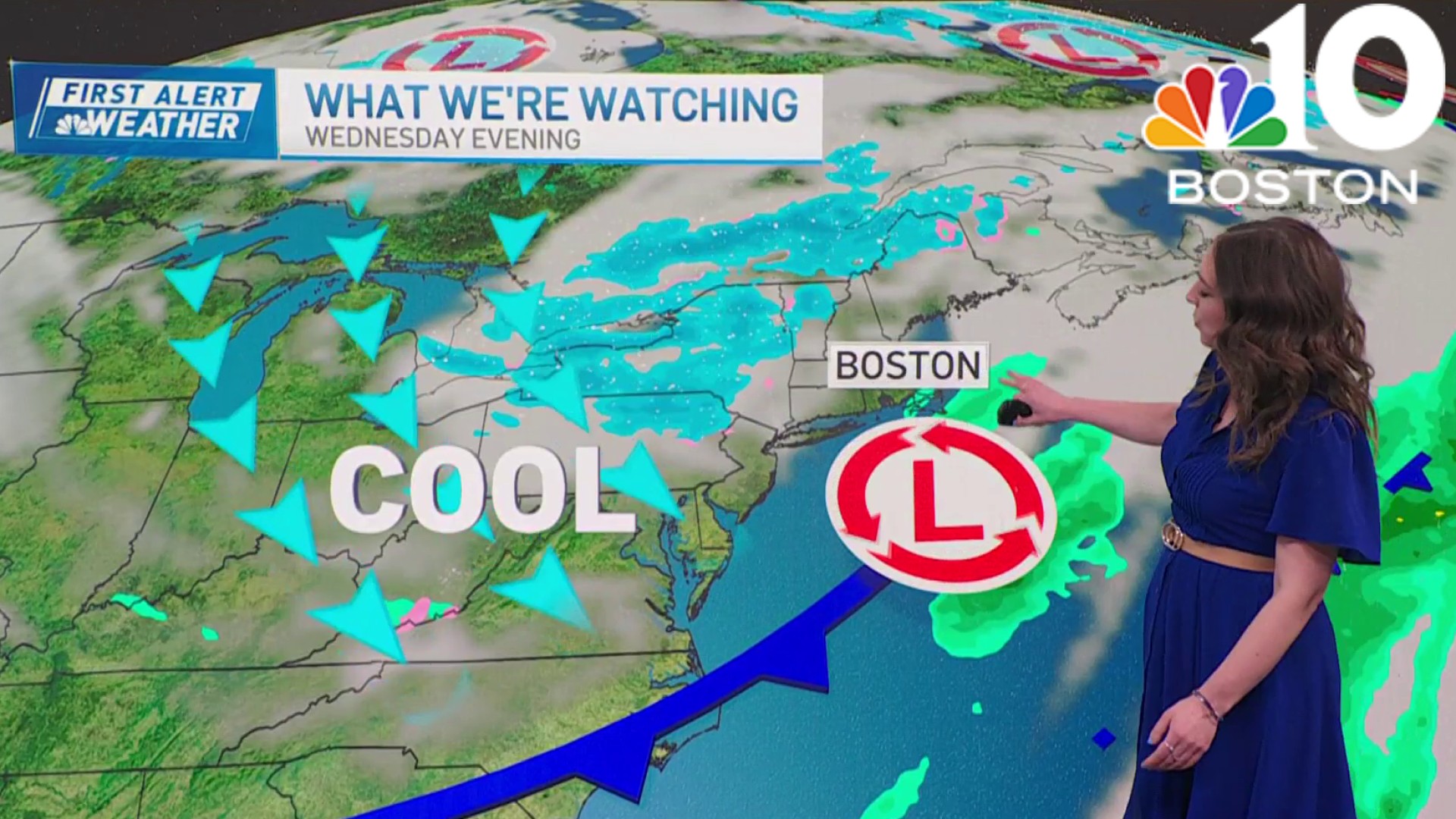
Meanwhile, across the Route 2 corridor, Worcester Hills, Berkshires and areas north and west light snow amounts to coatings to 1” in high terrain.
Northern New England's mountains pick up a couple of inches of snow through the day.

Track the weather system with this live radar:
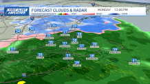
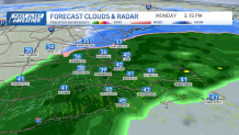
The rain in Boston lingers through late afternoon and tapers by the evening. Rain totals will be around 0.5” for most in southern New England.
We see temps staying in the 40s or 50s through next week, with a possible warmup by the next weekend, with highs maybe reaching the 60s.
Our next chance for rain is on Wednesday.