
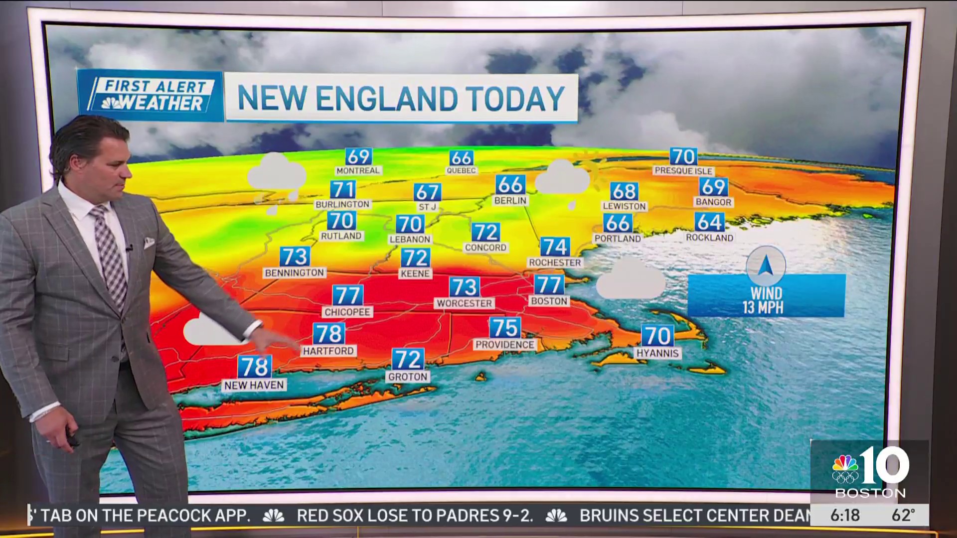
The heat makes a comeback Tuesday — minus the humidity. We're soaring into the mid and upper 80s thanks to the westerly winds.
There is the slightest chance the winds turn onshore right at the water's edge and through Cape Ann late this afternoon. But no matter, we'll still see reach into the 80s.
STAY IN THE KNOW
Watch NBC10 Boston news for free, 24/7, wherever you are. |
|
Get Boston local news, weather forecasts, lifestyle and entertainment stories to your inbox. Sign up for NBC Boston’s newsletters. |

Wednesday the wind turns to the southwest, so humid air returns in earnest. Highs climb to near 90 to make this the hottest day of the week. Thunder — along with severe weather — seems limited to western Massachusetts as a cold front approaches late into the afternoon.

Any storms will weaken Wednesday night, but there still could be some rumbles given the amount of lingering heat.
Showers will be around early Thursday morning, but we'll manage to sneak in the sun later in the day. We'll also see the humidity drop throughout the day.

Our pattern over the next 10 days can be summed up with up and down temperatures and humidity. Doesn't appear to be any prolonged heat or cool temperatures and no long spells of dry weather/rain.
Weather
I'll take that as a win.
