Strom clean up continues across southern New England from the severe storms Wednesday night. Luckily, the weather cooperates over the next couple of days.
Sunshine emerges Thursday, but as soon as it does, a secondary "cool front" will move in from northwestern New England. This, combined with daytime heating, will allow clouds to develop and some isolated pop-up showers to develop through sunset as the front heads through.
STAY IN THE KNOW
Watch NBC10 Boston news for free, 24/7, wherever you are. |
|
Get Boston local news, weather forecasts, lifestyle and entertainment stories to your inbox. Sign up for NBC Boston’s newsletters. |
Highs Thursday stay in the low 70s north, low 80s south. As the temps go up, our humidity lowers to dewpoints in the 50s by evening. Then, Thursday night, some extremely dry air returns, so it's another comfy and dry night to open the windows.
Lows dip to the 50s in city centers and into the 40s across the suburbs and north and west.

Highs on Friday and Saturday stay in the mid to upper 70s with tons of sun and dry air. It's a beautiful couple of days!
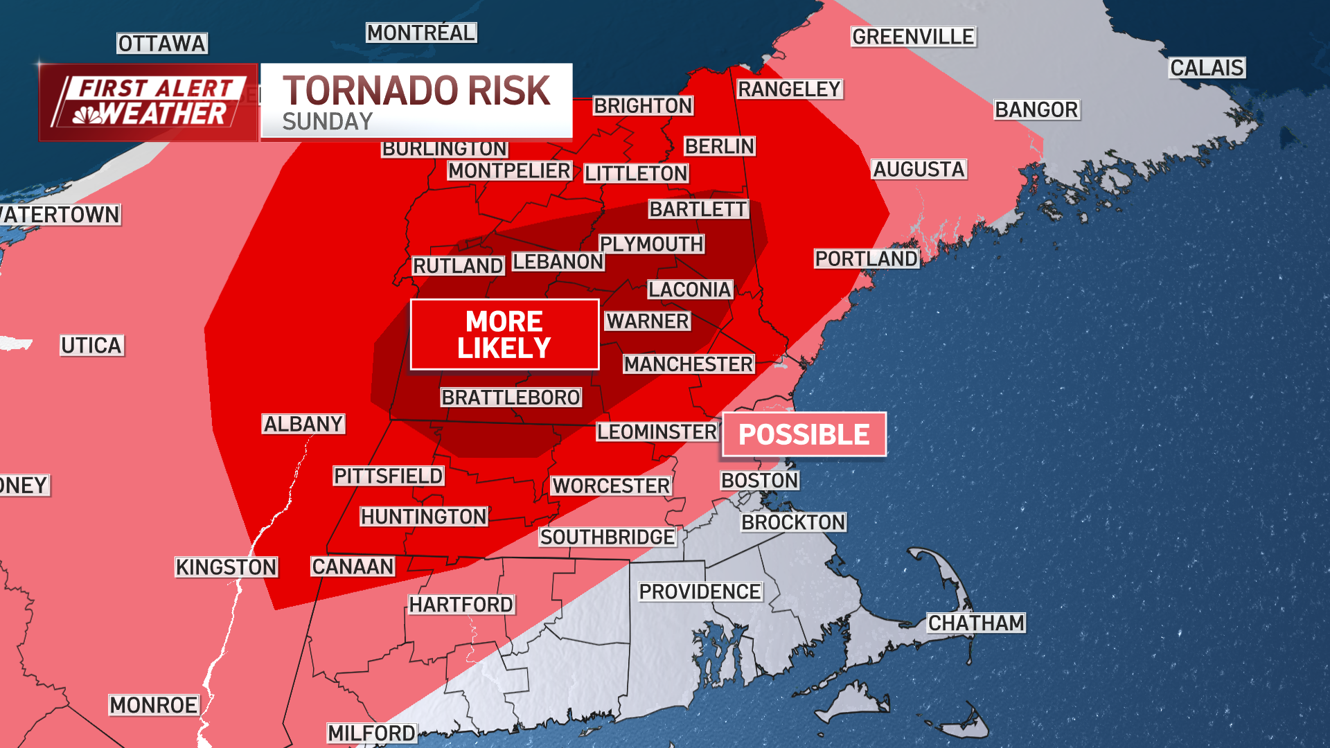
Humidity returns by Sunday as temps increase to the mid-80s. Another storm system approaches and will bring in a round of storms and showers by the afternoon through evening.
If the timing coincides with peak daytime heating hours, we may again see a round of severe storms. Stay tuned on this since the timing can still change.
After Sunday, high pressure returns and keeps away any rain through Wednesday next week for any July 3rd cookouts and celebrations.
Independence Day has a chance for rain or storms late in the day, but for now it does not look like a washout and the chance is pretty low.