Tuesday: Mild, limited sun to clouds, sprinkles. Highs in the 60s.
Tuesday Night: Passing showers through midnight. Lows in the 40s.
Wednesday: Sun and clouds. Highs in the 50s.
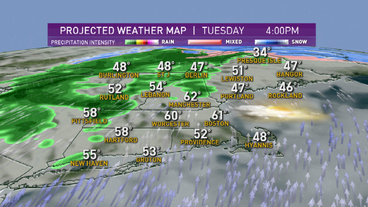
A backdoor cold front – a push of cool air from the northeast and east, rather than the usual direction approaching from the west – sent the temperature dropping from the Maine coast to southeast New Hampshire and northeast Massachusetts through the Boston area Tuesday morning.
For some, this new, cool air will be insurmountable when it comes to warming up Tuesday – from the Seacoast of New Hampshire northeast up the coast, it’s unlikely we’ll warm beyond the 50s.
Elsewhere, it may be a slow start, but even Boston should find a southwest wind eventually returning by Tuesday afternoon to bump temperatures into the 60s. All the while, a more typical cold front will be approaching from the west and will arrive to New England from west to east with showers ahead of it Tuesday afternoon and evening.
Rain amounts won’t be significant, with about a quarter of an inch falling in northern New England and only a few hundredths of an inch – enough for a few small puddles – in southern New England, giving way to returning dry weather Wednesday and Thursday.
In fact, when our First Alert Team looks at the next week, we don’t see more than about a third of an inch of rain all told for the Boston to Providence corridor, and not much more than a half inch to three quarters of an inch in northern and western New England, meaning with no leaves on the trees to shade last year’s dead brush and leaves on forest and grassy floors, we’ll find brush fire danger continuing to rise quite high in the several days ahead.
The dry weather and relative warmth will also send the pollen count up across New England, with the exception of one day of returning showers Friday which actually may end as a touch of snow in northern New England Friday night to give a little bit of fresh snow for spring skiers headed to the mountains this weekend.
Otherwise, the weekend looks dry and bright for New England Saturday and Sunday, with cooler air in place particularly Sunday into Monday.
Local
In-depth news coverage of the Greater Boston Area.
Our next chance of showers arrives Tuesday and heralds the arrival of warmer than normal air all over again, delivering showers on Saint Patrick’s Day and temperatures around 60 degrees on Thursday, when the vernal equinox marks the start of astronomical spring, and spring on your calendar, just prior to midnight Thursday night.


