


Friday: Morning fog then partly cloudy. A stray shower or two possible. High in the low 70s
Saturday: Cloudy with occasional showers. High in the mid 60s
Sunday: Clouds clearing. Breezy with Sun. Highs in the low 60s.
Sunshine and mild temperatures have taken over Thursday afternoon after dense fog advisories had to be issued in the morning. Our warmest temperatures are seen along northern New England Thursday with mostly clear skies. Highs range from the mid 80s along the valleys north, 70s along the coast and 60s on the Cape to much of coastal Maine.
Maine and northwestern New England are set to see the biggest rainfall impacts, with likely higher amounts. While southeastern New England may see as little as half an inch of rain, western Massachusetts, northern Vermont and Maine may see around two inches or more in localized areas, especially in northeastern Maine who may see the landfall of Tropical Storm Philippe late Saturday.
STAY IN THE KNOW
Watch NBC10 Boston news for free, 24/7, wherever you are. |
|
Get Boston local news, weather forecasts, lifestyle and entertainment stories to your inbox. Sign up for NBC Boston’s newsletters. |


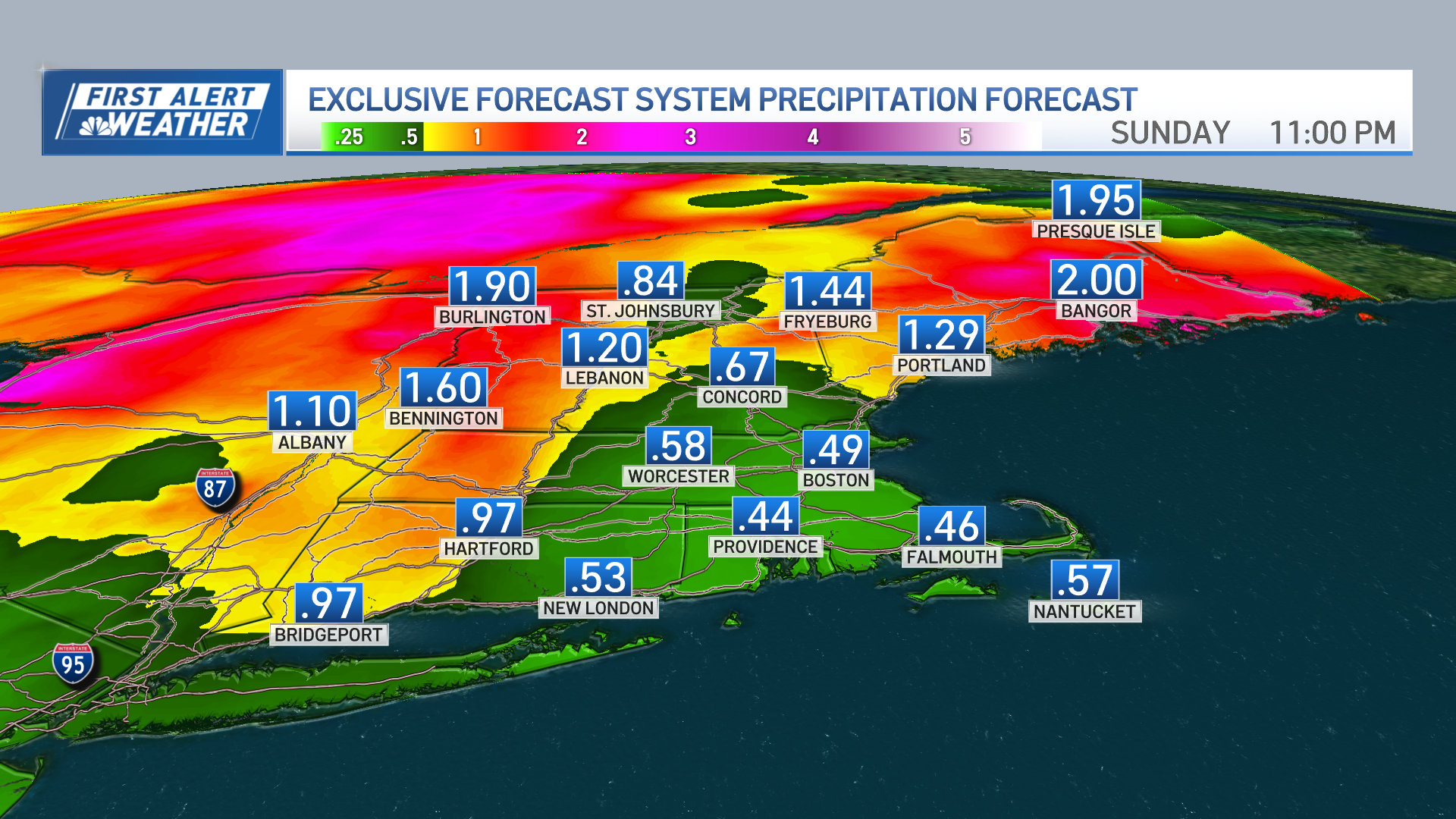
The frontal boundary moving out of the west in combination with Atlantic moisture may bring in showers that arrive as early as Friday afternoon from the Berkshires to Vermont. The tropical moisture provided by Philippe may reach southeastern Massachusetts as early as Friday night into Saturday mid morning throughout the day.
Get top local stories in Boston delivered to you every morning. Sign up for NBC Boston's News Headlines newsletter.
Progressively spreading across eastern New England, pockets of heavy rainfall will be expected Saturday but should push out through Sunday increasing sunshine earlier in southern New England on the latter half of the weekend.
We’ll see a blustery Sunday with temperatures in the 60s to 50s lasting through early next week. After that, highs ranging in the low 60s should stay below average through the rest of the work week.
