


Today: Variable clouds to a few afternoon showers/thunder. Highs in the 80s. Wednesday: Sun and clouds, isolated afternoon thunder possible. Highs in the 80s.
We’re still in line for more showers going throughout the week. We can’t seem to shack the wet weather.
Flash flooding will grow as a concern throughout Tuesday. Flash flood watches stretch through northern Middlesex County, Worcester County and through northern New England. While not everyone will see the downpours, those that do could trigger an imminent flash flood threat — particularly along the lowest lying streams, creeks and rivers.
WATCH ANYTIME FOR FREE
Stream NBC10 Boston news for free, 24/7, wherever you are. |


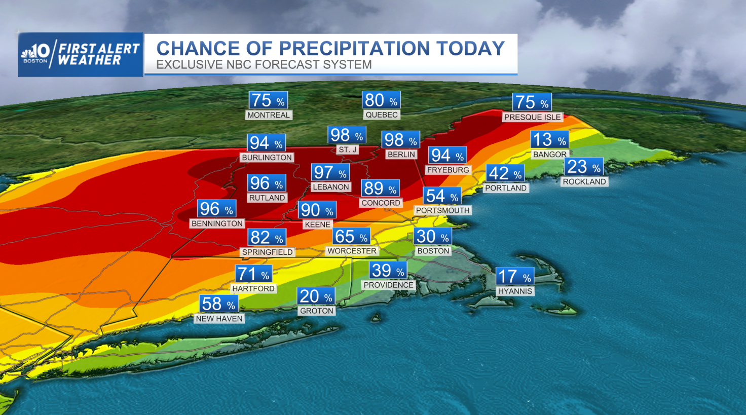
Tuesday’s system should be out by the day’s end, with most rain dissolving as the showers enter the pike. Most rivers are near flood stage, but not exactly in the upper echelon of heights. Damaging wind and hail are additional threats, but the window opportunity will be narrow.
Get updates on what's happening in Boston to your inbox. Sign up for our News Headlines newsletter.
Of a much larger concern for all New England, and the Northeast, will be the plumes of smoke that drape our skies. Smoke from Canadian wildfires burning in Alberta and the Western Provinces has been lofted in the jet stream, bringing smoke through the Midwest, Mid-Atlantic Coast, and northeast. Air quality alerts have been issued for Tuesday and those with respiratory ailments, and asthma, should limit time outdoors.
