We’re tracking a decent weekend here in Greater Boston, but if you’re heading to the beach, think twice before going into the water.
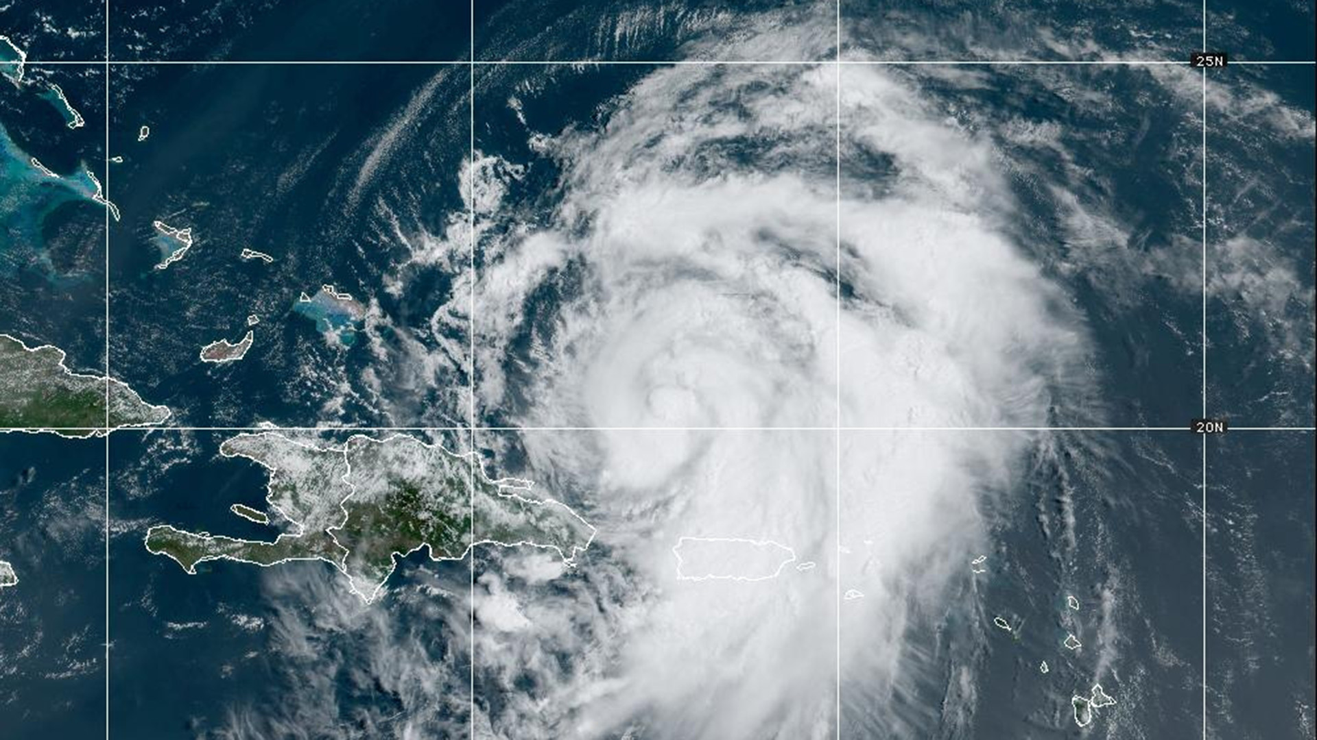
There is a high threat of rip currents at our south facing beaches here in southern New England through Sunday evening all due to Hurricane Ernesto.
STAY IN THE KNOW
Watch NBC10 Boston news for free, 24/7, wherever you are. |
|
Get Boston local news, weather forecasts, lifestyle and entertainment stories to your inbox. Sign up for NBC Boston’s newsletters. |

The storm will bring heavy rain, flooding, and gusty winds to Bermuda on Saturday before heading north. While Ernesto will not make landfall in the U.S., the hurricane’s swell will create dangerous ocean conditions with 5-8 ft waves and a big threat for rip currents.
Get top local stories in Boston delivered to you every morning. Sign up for NBC Boston's News Headlines newsletter.
Use extra caution before getting into the water this weekend.

As for our weather on Saturday, we’re expecting areas of fog during the morning. Then, we’ll see clouds and some sunshine along with some haze from the wildfire smoke in Canada.
No rain is expected for much of Greater Boston Saturday with highs in the upper 70s to near 80. On Sunday, we’ll see partly sunny skies before a cold front approaches Eastern Mass by Sunday evening, giving way to a few late day showers. High temperatures will be in the upper 70s.

Rain chances will increase into Monday as the cold front slowly moves through our area. Pockets of heavy rain are possible. We can’t rule out a rumble of thunder. Rain will likely linger into Tuesday. Highs on Monday and Tuesday will be in the mid 70s.
By Wednesday and Thursday, temperatures will start each morning in the upper 50s!