Tuesday night: Mostly clear. Lows in the mid 60s. Wednesday: Sunny, highs in the 80s, 90s inland. Thursday: Mostly cloudy, scattered AFTERNOON showers or storms inland. Highs in the low 80s.
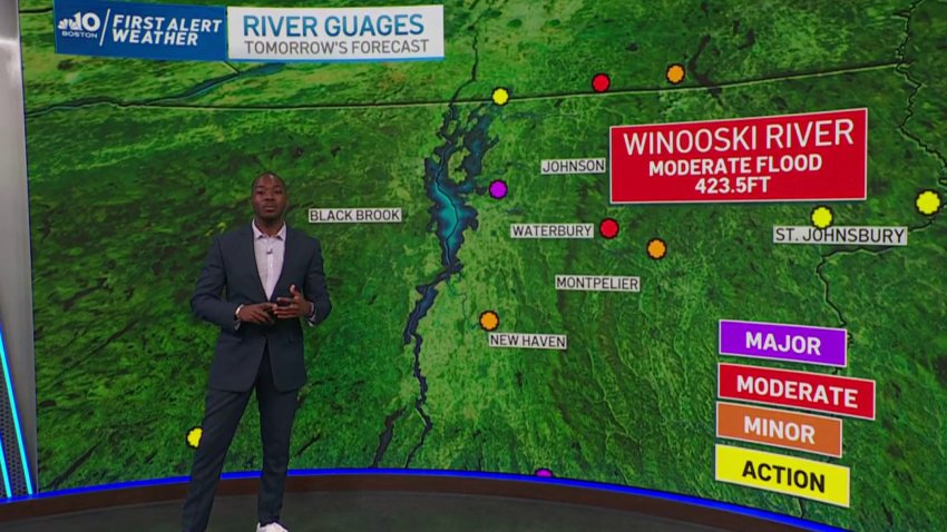
Flood warnings remain in effect in Bennington, Caledonia and Grand Isle Counties in Vermont.
The torrents of rain have moved off, but the incredible images from Vermont are still trickling in. Heavy flooding in spots rivaled and even surpassed what was seen in Irene. While the rain has stopped, the larger stem rivers continue to slowly tick up. Thankfully, the water should slowly recede in the days ahead, but the recovery is just getting started.
WATCH ANYTIME FOR FREE
Stream NBC10 Boston news for free, 24/7, wherever you are. |


Get updates on what's happening in Boston to your inbox. Sign up for our News Headlines newsletter.
There are brighter, hotter days ahead for all of us. Humidity should take a little hit Tuesday, before resurging again in the days ahead. This puff of slightly drier air is short-lived thanks to the active pattern swirling overhead. That also means we’re not finished with the wet weather, either.
Mid and upper 80s should do it Tuesday. By mid-week, the temps soar into the low 90s, and even Boston has a chance to make it to 90 for the first time this year (at least at Logan Airport). Heat indices will be very uncomfortable in the low 90s by afternoon, so take it slow and easy in the afternoon. We’ll sink back a bit by Thursday and Friday with clouds thickening and the chance for thunder and downpours growing.

Right now, the weekend is struggling with a few storms and showers expected to visit the area. We aren’t seeing washouts, but there will be some drops to dodge.

