Overnight Tuesday night: Still Dry. Partly Cloudy. Low: 72. Wednesday: Morning Sun & Clouds. Evening Showers & Storms. High: 91. Thursday: Warm. Drying Out. High: 83.
You've heard the saying, "It's not the heat, it's the humidity" when describing sweltering summer days. However, Tuesday's exactly the opposite.
There's plenty of heat, but humid conditions are at bay for the next day, to day-and-a-half with winds from the northwest. This will help keep comfortable conditions in place, as temperatures rise back near 90° region wide.
WATCH ANYTIME FOR FREE
Stream NBC10 Boston news for free, 24/7, wherever you are. |
Tuesday is dry though and Wednesday starts rather dry, too. A renewed chance of rain arrives late Wednesday evening.
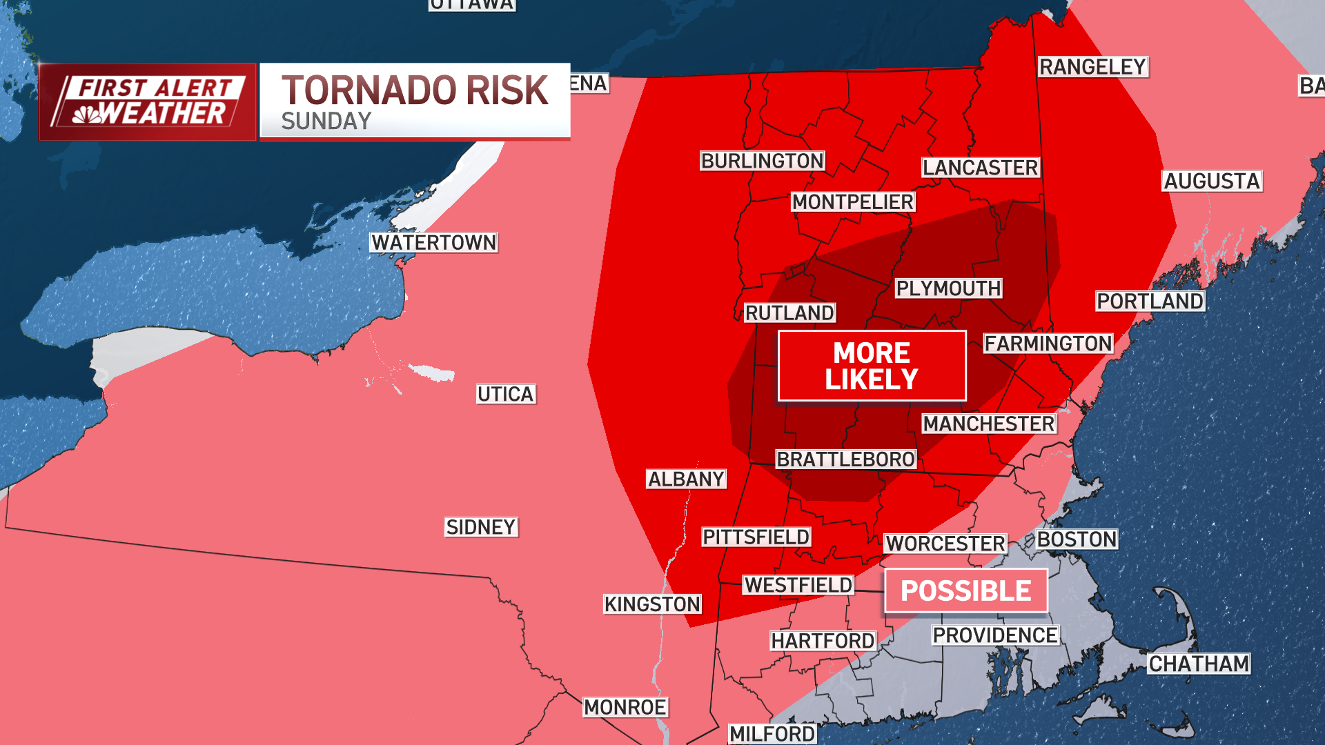
For now, timing plays in our favor, with the brunt of things after the 5 p.m. commute. We have issued a First Alert for the chance of strong and damaging thunderstorms, but the components of severity right now are lower.
Get updates on what's happening in Boston to your inbox. Sign up for our News Headlines newsletter.
The focal point for the worst of the storms will be through Upstate New York. But we'll need to be on guard (indoors and outdoors) as severe weather remains nearby.
Into the weekend, drier and cooler air is back for Friday and Saturday.