
Friday: Sunny start, showers by late day into the evening. Highs in the 50s.
Overnight Tonight: Showers. Lows in the 40s.
Saturday: Mostly cloudy. Morning showers depart for a mostly dry day. Highs in the 50s.
Sunday: Rain likely, North Country mountain snow. Highs in the 40s.
The mild temperatures peak Friday as sunshine holds sway through the morning. Although limited these days, it should be enough to boost us into the low and mid-50s this afternoon.
Breezes from the southwest continue as the clouds slowly increase from the west.
WATCH ANYTIME FOR FREE
Stream NBC10 Boston news for free, 24/7, wherever you are. |
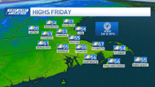
Showers are moving east as well. While this isn't a big rainmaker, we should see some wet weather by late afternoon/evening. All of it will fall in the first half of the night, then make a quick exit by morning.
Get updates on what's happening in Boston to your inbox. Sign up for our News Headlines newsletter.
We're left with a lot of clouds Saturday, but we can't rule out a few rays of sun from time to time, either. This will be our only dry day of the weekend.

Sunday's showers will get a jump on us early, but the heaviest rain will wait until Sunday night. As colder air works in from the north, the rain/snow will drop south late night.
Weather
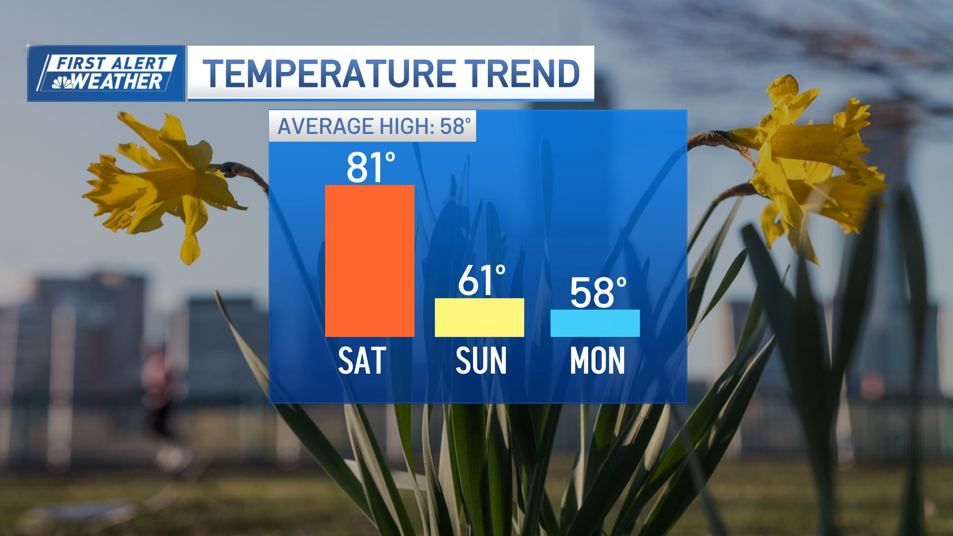

Some mix could come into the picture by Monday morning in central Massachusetts and southern New Hampshire, but the prospects for accumulation remain low — and limited to higher terrain — given the mild temps near 50 on Sunday and the gradual nature of the cooling.
Our storm departs on Monday, but there still may be a few showers around through at least early afternoon.
Have a great weekend!