Today: Increasing AM clouds, afternoon rain. Highs upper 40s. Overnight Tonight: Rain, few moderate burst, breezy, some patchy fog. Lows low to mid 40s. Sunday: Few AM showers, lots of PM clouds, lingering drizzle coast. Highs low to mid 50s inland, upper 40s coast.
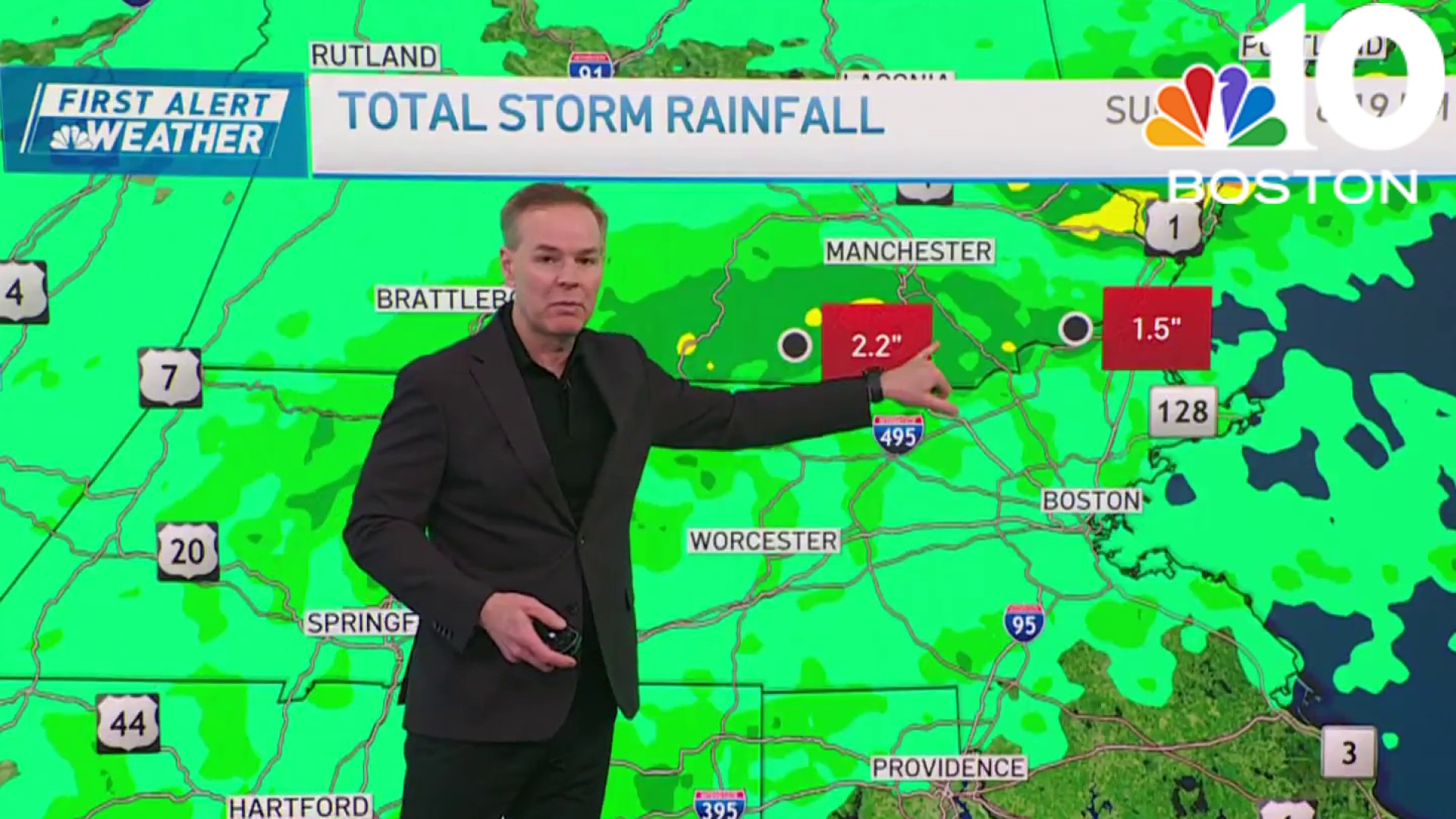
It’s not the most ideal spring weekend, but we’ll make do. Rain will hold back until lunchtime today, but when it sets in, it’s here to stay for the night. Some bursts of moderate rain can be expected as this system moves through, and when the dust settles tomorrow morning, we could see up to an inch of water in some towns and cities.
While no one wants to give up a weekend day to rain, it’s worth mentioning that this water is critical reserves for the warmer months ahead. We had zero late-season runoff from winter snow, so without frequent rain, we’d have no way to replenish the groundwater. (And we’d be very vulnerable to a flash drought.)
Stream NBC10 Boston news for free, 24/7, wherever you are.

Low clouds, fog, mist, and drizzle will spill into Sunday morning. Once we peel back the ick, we should be treated to a (partly) sunny afternoon in some spots.
Get updates on what's happening in Boston to your inbox with our News Headlines newsletter.
There is a SOLID opportunity for some towns & cities to touch 60 far from the coast! Along the coast, however, the cooling breezes off the water will ensure upper 40s to near 50.

We’ll all cool a bit Monday with a decent supply of sun, before another storm system moves in Tuesday. If you’re counting, that would make two in the next four days.
Unfortunately, there are two more after that: one on Thursday and another for next weekend. We’ll also be on the cooler side of both those weather systems, so we’ll keep our eyes peeled for any wet snow or mix.

Make the best of your weekend and be safe!