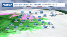
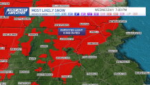
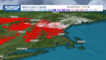
A few slick spots remain Wednesday afternoon in northern New England after a night of light snow and a mix.
Any precipitation Wednesday will be light and not a huge problem since it falls during daylight hours and road crews have been able to keep up with the icy spots on main thoroughfares.
WATCH ANYTIME FOR FREE
>Stream NBC10 Boston news for free, 24/7, wherever you are. |
Another round of rain moves in Wednesday night into Thursday morning. And we do stay rain in southern New England as temperatures rise overnight to the 40s by morning.

Get updates on what's happening in Boston to your inbox. Sign up for our >News Headlines newsletter.
Light ice is still possible in the mountains and across western to central Massachusetts Wednesday through Wednesday night, lingering to the first part of Thursday.
Highs soar to the 40s and low 50s south on Thursday. Scattered rain will taper a bit to some spotty showers by afternoon. Friday has changed just a touch in the forecast with some cooler temperatures thanks to a northeasterly airflow.
Scattered rain dominates the first half of the day with some drying in the late afternoon
Most areas stay under 1 inch of rainfall over the next couple of days. However, the rainfall may be a bit heavier across Rhode Island and the state is under a flood watch. Urban flooding and the Pawtuxet River is forecast with a crest near moderate flood stage by Saturday.

We cloud up on Saturday as temperatures remain in the low 40s. A larger storm system approaches on Sunday into Monday.
We will see some strong winds Sunday night, heavy rain to perhaps snow accumulation as the storm departs Monday morning as colder air funnels in.

Temperatures fall to the 20s and teens up north Monday afternoon, with some 30s for midweek next week and a break from any precipitation through the end of the 10-day.


