


Thursday night: Showers and fog. Lows in the 40s, 30s north. Friday: Showers. Highs in the 40s. Saturday: Isolated showers. Highs in the 40s.
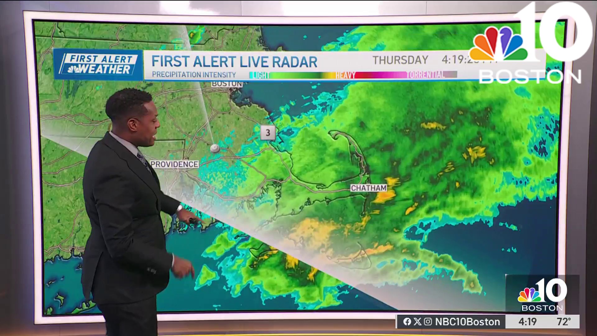
Rain continues through Thursday with cooler temperatures compared to Wednesday. Rain will be heaviest late morning to early afternoon due to low pressure passing off Nantucket.
However, the steady rain will ease into lighter showers, mist and drizzle later in the afternoon, making the evening commute better than the morning. Friday, the chance for scattered showers remains but not as widespread and steady as Thursday. Around 1 to 1.5 inches of rain is expected through Friday, but this storm won't bring strong winds.
STAY IN THE KNOW
Watch NBC10 Boston news for free, 24/7, wherever you are. |
|
Get Boston local news, weather forecasts, lifestyle and entertainment stories to your inbox. Sign up for NBC Boston’s newsletters. |


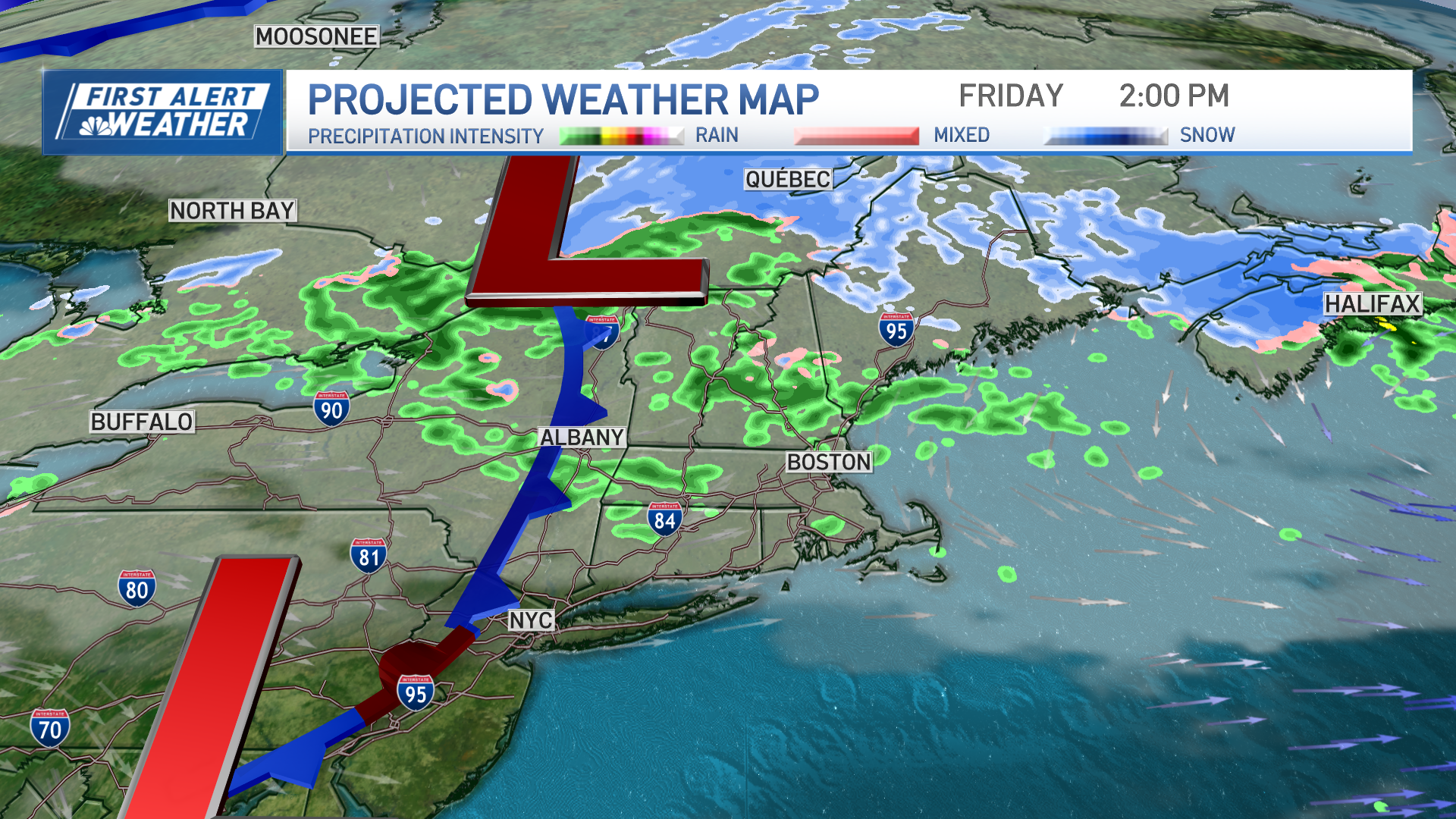
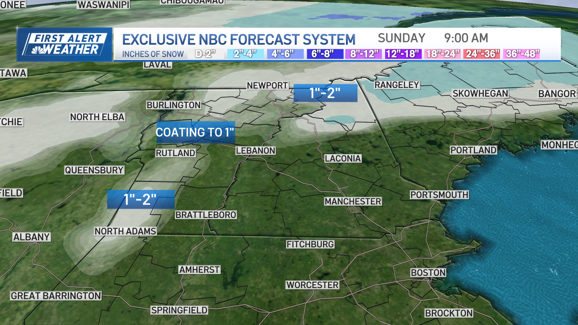
Friday, a weaker upper-level storm system will bring a few passing showers and cooler temperatures in the 40s. Northern New England will see the rain changing over to sleet and eventually snow for Friday and Saturday. There's still a slight chance of a quick shower on Saturday, but it'll be drier overall with some sunshine.
Get top local stories in Boston delivered to you every morning. Sign up for NBC Boston's News Headlines newsletter.
New Year's Eve and Day look like the best days of the holiday weekend. There will be a mix of sun and clouds, cool and dry weather, and light winds.
Temperatures will drop to the mid-30s at midnight on New Year’s Eve and fall further to the 20s by dawn on New Year’s Day. Looking ahead, temperatures will generally be cooler with a couple of storms passing far offshore.

At this point, there aren't clear signs of significant snow threats, but the weather pattern could change rapidly in the near future.
