
We're still under the influence of some upper level energy Tuesday — which as it rotates through will serve to bubble up clouds and some spotty showers, similar to Monday, though not quite as numerous.
Temperatures will once again be in the upper 50s to low 60s, slightly below average for this time of year.
STAY IN THE KNOW
Watch NBC10 Boston news for free, 24/7, wherever you are. |
|
Get Boston local news, weather forecasts, lifestyle and entertainment stories to your inbox. Sign up for NBC Boston’s newsletters. |

Wednesday will feature an even lower risk of showers, but there will still be an isolated chance you'll have to dodge a light shower or two, particularly along the south coast. It will be slightly milder in the low to middle 60s with varying amounts of sun and clouds.
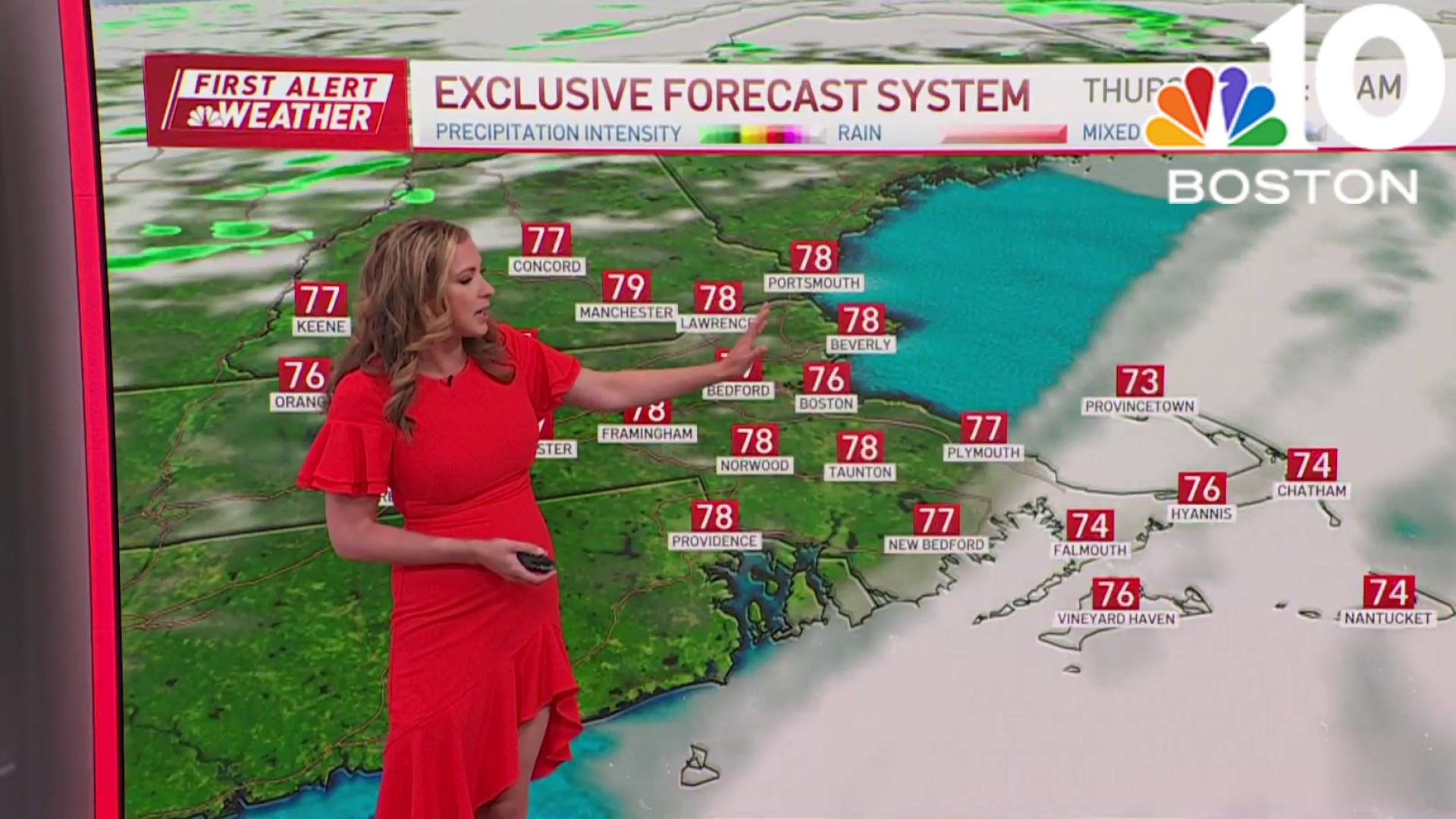
High pressure will be the dominant feature on the map for Thursday, resulting in a beautiful fall day regionwide. Clouds and showers return on Friday ahead of a disturbance developing off the North Carolina coast and an incoming front from the west.

These two features will merge over the Northeast on Saturday bringing a period of rain, though the exact timing and placement is still a bit uncertain. The storm center will consolidate over Maine on Sunday, keeping the threat for pockets of rain around in northern New England on Sunday, while southern New England could sneak away with a mostly dry day as cooler, drier air filters into the area.
Weather

Next week's weather looks bright and quiet, with a shot of cooler air to start the week before temperatures moderate again by Wednesday and especially Thursday.
Overnight lows Monday night and Tuesday night are likely to dip into the 30s for many of us, so we’ll monitor the potential for frost in the days to come.
