
As you travel about today, you’ll probably see and pick up the smell of smoke here and there. The reason being is that the Boston area has been so dry during this fall season that it's resulted in many brush fires, especially over the past couple of days due to low dewpoints and gusty winds.
WATCH ANYTIME FOR FREE
Stream NBC10 Boston news for free, 24/7, wherever you are. |
Dry leaves and underbrush have increased our risk for brush fires and Monday will be no different, with an elevated risk for much of southern New England into New Hampshire. Outdoor burning is not recommended, and extra caution needs to be practiced outside with ignition sources, especially properly extinguishing smoking materials.

Get updates on what's happening in Boston to your inbox. Sign up for our News Headlines newsletter.
This afternoon will be on the cooler side with sunshine and a few clouds around. Dry conditions will be the theme today which will make it easier for brush fires to crop up, thankfully the wind won’t be as gusty as yesterday which won’t allow them to spread as fast. Highs today reach the low to mid 50s, 40s north along with a north wind 8-16 mph.

A chilly night is expected tonight thanks to a clear sky, light wind, and low dewpoints allowing for some good radiational cooling in some of the inland valleys and low lying communities. Lows tonight will bottom out in the low to mid-30s for much of the area, few 20s in the traditionally colder spots as well as central and northern New England.

More in the way of clouds around Tuesday as a warm front approaches the region. Wind will switch to the south during the day which will help usher in much warmer temperatures through the mid-week period. It’ll take a day before we see those warm temps, so we’re expecting highs to be mainly in the mid-50s south, upper 40s to low 50s north.

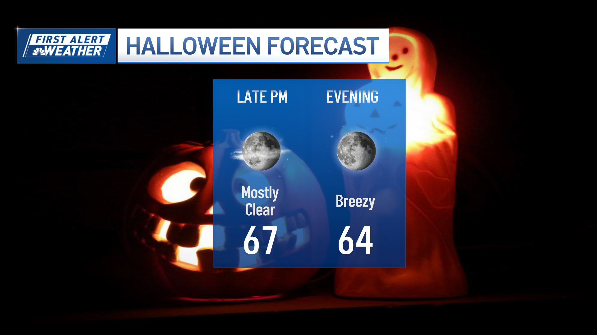
A few showers are expected Tuesday night but we're not expecting anything drought-busting. Big changes in the temperature department arrive Wednesday with highs breaking into the 70s and even warmer on Halloween, with highs reaching the upper 70s, perhaps a few 80-degree readings southwest of the City and into the Merrimack Valley! The record high in Boston for October 31 is 81 and we may come close!
Weather Stories

A cold front will pass through the region Thursday night and early Friday with a few showers along it, some of which may linger into the midday hours on Friday. Cooler, more seasonable conditions follow into the first weekend of November.