
Monday morning’s commute may be slower than normal due to the weather moving through the region.
Follow NBC10 Boston:
https://instagram.com/nbc10boston
https://tiktok.com/@nbc10boston
https://facebook.com/NBC10Boston
https://twitter.com/NBC10Boston
https://bsky.app/profile/nbcboston.com
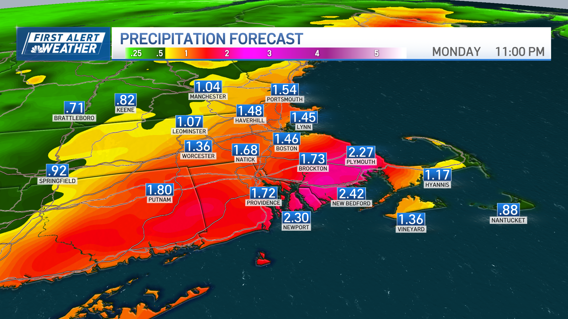
Heavy rain and gusty winds are making for a messy Monday morning commute, with the heaviest downpours impacting areas along the I-95 corridor to the South Coast.
Rainfall totals of one to two inches are expected, with some localized spots approaching 3 inches, which could lead to areas of urban flooding and ponding on the roads.
WATCH ANYTIME FOR FREE
Stream NBC10 Boston news for free, 24/7, wherever you are. |
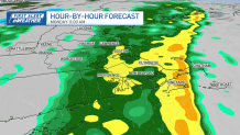
Low spots with poor drainage will start to pick up water. Gusty south winds up to 45 mph are possible. Rain will gradually taper off from west to east through the afternoon, lingering the longest across Cape Cod and the Islands. Temperatures will stay mild, with highs in the upper 50s to low 60s.
Get updates on what's happening in Boston to your inbox. Sign up for our News Headlines newsletter.
Drier conditions return on Tuesday under high pressure, with some lingering clouds and seasonably warm highs in the mid-50s.

Wednesday will also stay dry before another system moves in Thursday night into early Friday, bringing another round of rain showers.
Weather Stories

This system won’t be as intense as Monday’s storm, but will usher in breezy and cooler conditions, with highs in the 40s on Friday.
Looking ahead to the weekend, temperatures will briefly rebound into the low 50s on Saturday before another front moves through, bringing a chance for showers and a return to more seasonable temperatures by Sunday.