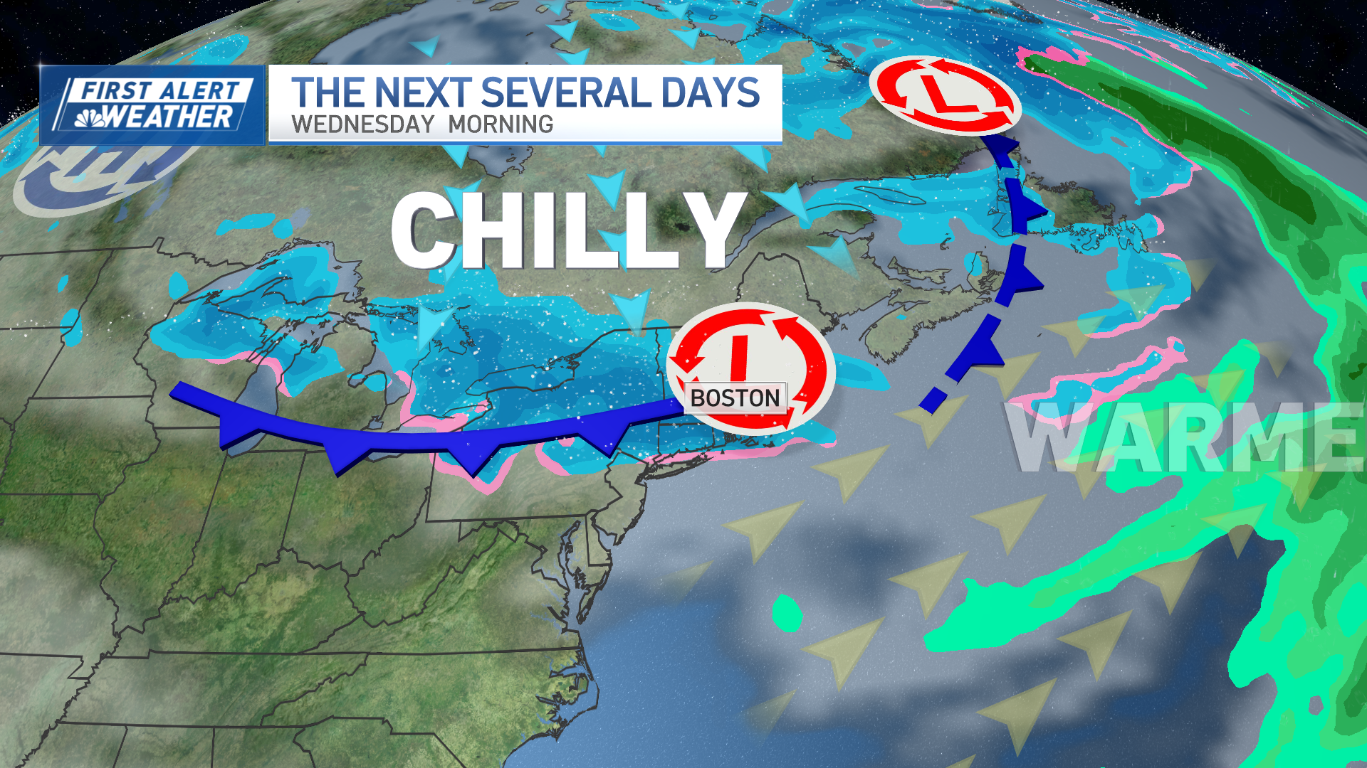
Today (Friday): AM showers to rain to snow/rain bursts by evening. Highs in the 40s. Overnight Friday Night: Mixed showers end as snow showers, snow Northern New England. Lows around 30. Saturday: Blustery and cold, fair sky, mountain snow showers. Highs near 40, wind chill 20s.
Although Friday dawned with temperatures warm enough for raindrops for nearly all of New England, some far northern communities along the Canadian border were cold enough to already observe a combination of rain and snow falling lightly, including Newport, Vermont.
This is just the beginning of a trend for rain to change to snow and colder air to stream into New England in conjunction with a storm center developing over the waters just east of New England along a slow-moving but well-defined cold front drifting from west to east.
WATCH ANYTIME FOR FREE
Stream NBC10 Boston news for free, 24/7, wherever you are. |
For most, rain expanding Friday will continue to fall lightly but steadily through much of the day, not raising any problems with flooding by any means, but slowing travel on the roads and making for soggy Black Friday shopping.
Winds will stay fairly light through the day, but start increasing from the west as the aforementioned storm intensifies while moving over the Gulf of Maine late in the day into Friday evening, carrying colder air into New England both at the surface and aloft. With the cold air arriving high in the sky first, mountain summits start piling up snow first, but the snow level drops in altitude during Friday afternoon, eventually reaching valley floors of Northern New England by sundown and continuing to march slowly south and east Friday evening, affording a mix with and change to snow even for northern Conn. to the Boston Metro area during the evening to first part of the night.
Get updates on what's happening in Boston to your inbox. Sign up for our News Headlines newsletter.
In northern New England, the heavy, wet nature of the snow may deliver some power outages where accumulations exceed four inches, which is expected in and around many of the mountains of VT, NH and ME, and roads will deteriorate for winter driving conditions.
Snow will have trouble sticking to roadways in Southern New England coming off a day of high temperatures in the 40s and with air temperatures barely reaching freezing overnight Friday night, but in places where two or more inches of snow falls on the grass, that’s enough ice crystals dropped on the road to result in some greasy, slushy snow on roads, which likely will include the Monadnock Region and may include northwest Worcester County…and perhaps parts of Southern NH. In Eastern MA, even if snow melts on roads, the wet roads may turn just cold enough by 5 or 6 AM Saturday for patchy ice as air temperatures drop.
The cold air Saturday will hold daytime highs shy of 40 degrees for most, and a west wind gusting to 35 mph will keep the wind chill in the 20s for even the warmest time of the day, making sunshine ineffective as mountain snow showers continue. The wind eases Sunday but the air should be equally cold and sun will fade behind increasing clouds as an energetic disturbance approaches aloft.
Weather Stories
This disturbance is one that was eyed for possible storm development along our coast this past week, but continues to look flat enough and fast enough to preclude fast enough storm development, instead likely to bring some light snow to Upstate NY and PA Sunday, then some snow or mixed snow and rain showers to New England overnight Sunday night into Monday.
Cool air is expected to linger through most of the week, not breaking until the end of the week in our exclusive First Alert 10-day forecast.


