Hurricane watches and warnings have been hoisted in parts of New England and, depending on the exact strength at landfall, the region may be staring down the barrel of the first direct hurricane strike to our coast since Hurricane Bob in 1991.
Hurricane warnings are in effect in New Haven County, New London County and Middlesex County in Connecticut, with other severe weather advisories also being issued.
WATCH ANYTIME FOR FREE
>Stream NBC10 Boston news for free, 24/7, wherever you are. |
We've seen plenty of tropical storms, decaying hurricanes and nor'easters, but a storm of this magnitude, making a direct strike as a hurricane, hasn't come calling in 30 years.
Get updates on what's happening in Boston to your inbox. Sign up for our >News Headlines newsletter.
So, it's all eyes on Henri as the system -- currently a tropical storm -- is predicted to strengthen to a hurricane strength as it drifts squarely over the warm waters of the Gulf Stream, the warm current of ocean water off the Eastern Seaboard that favors storm strengthening.
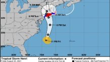
If the storm follows the latest official track and intensity from the National Hurricane Center, it will make landfall along the southern coast of New England as either a strong tropical storm or minimal hurricane, with widespread wind damage and power outages, flooding rain, coastal flooding due to high tide and storm surge and significant loss of property.
But the impact on the Boston area may be diminishing, while Connecticut and Western Massachusetts could face a stronger blow. Friday's updates at 5 and 11 p.m. from the National Hurricane Center each shifted Henri’s track further to the west, putting it on an expected path over parts of Long Island and Connecticut, moving the strongest effects away from the Boston area, at least for now.
On Friday afternoon, Connecticut Gov. Ned Lamont declared a state of emergency, activating members of the National Guard. Massachusetts Gov. Charlie Baker did the same earlier in the day.
However, hurricane watches were still in effect along the shore of southeastern New England, out to Cape Cod. New hurricane warnings and watches were issued to the west, into the New York City area.

The details of the following forecast may change, if the hurricane continues to track west. We'll be monitoring and will have updates on NBC10 Boston and NECN.
Mass., New England Forecast for Friday, Saturday
Conditions are expected to deteriorate rapidly Sunday morning, after two relatively benign days Friday and Saturday.
With lots of clouds and an occasional shower Friday, humidity continues but will build even more Saturday as a light southeast wind begins, carrying truly tropical air into New England ahead of the strengthening storm to our south.
As dew point temperatures rise and the moisture content of the air increases, sunshine will give way to building clouds and scattered afternoon tropical showers -- still innocent enough.
Clouds increase Saturday night and problems compound Sunday as the southeast wind strengthens across southern New England early in the morning. With rip currents gradually building at New England beaches over the weekend, beachgoers will need to exercise caution, particularly with kids.
Henri is coming in on the heels of Tropical Storm Fred, which inundated Worcester and other parts of central Massachusetts with flooding.
"Since the storm yesterday, we've gone around and cleared catch basins, double checked all the pipes, the pumps, everything was operational, seems to be operational today," Worcester Public Works Commissioner Jay Fink said Friday.
Fink says his crews will also be proactively trying to avoid a repeat of cars submerged in rising floodwaters.
"What we're going to do is pre-position barricades so that as soon as the water starts to show on the streets, we're going to place barricades, try to keep the cars out of there," Fink said.
Up the road in Clinton, it's a race against time to take down the twisted tree limbs and clear debris after a tornado touched down there Thursday.
"We do have a fair amount of hanging limbs out back that I'm worried about, so we have to try to cut those down before the hurricane," said Bruce Williams.
Bruce and Debra Williams are cleaning up her parents' Clinton home after it sustained damage in the twister while her parents head home from Cape Cod.
"They're going to be coming home, hopefully tomorrow, and sort of threading the needle between the tornado and the hurricane," Debra Williams said.
Henri's Expected Impacts Sunday
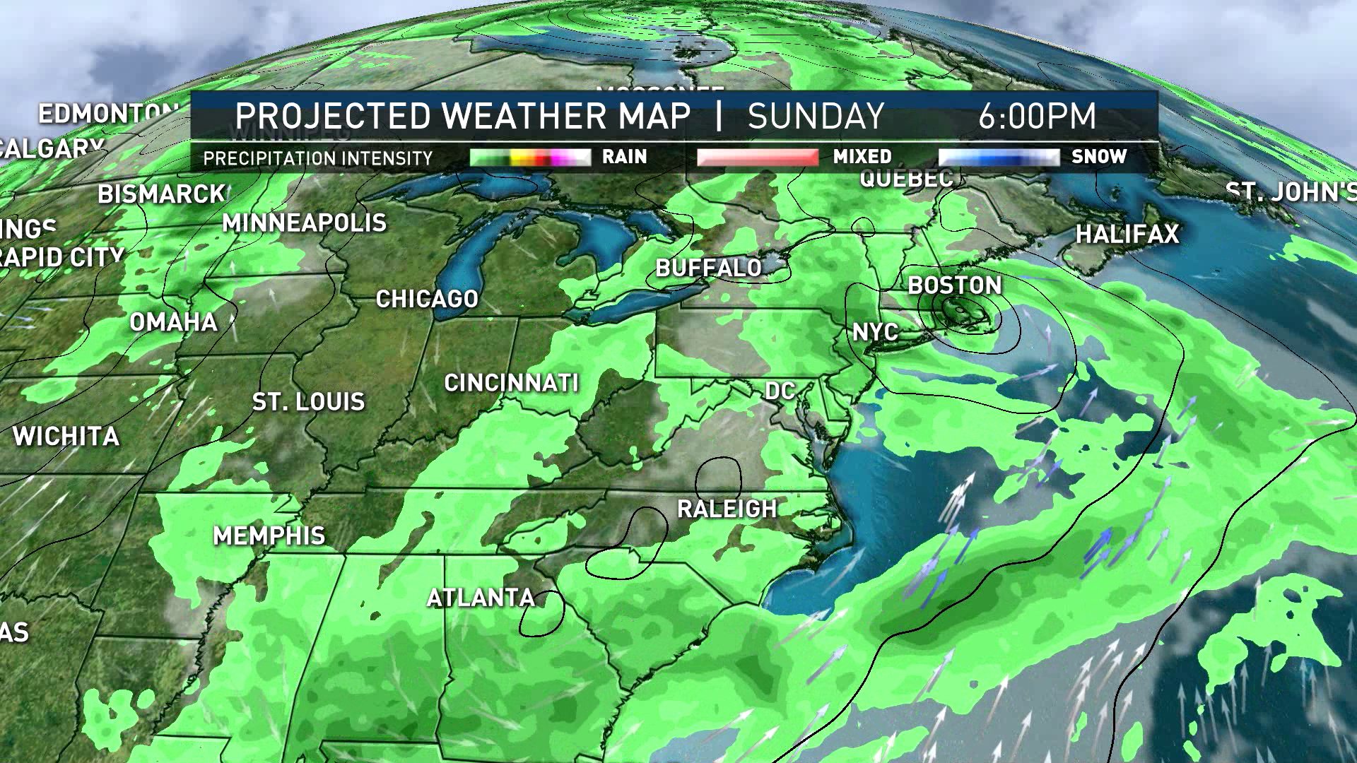
Henri will waste no time Sunday, with bands of rain and gusty wind arriving to southern New England by early to mid-morning and conditions will rapidly deteriorate over the morning to midday. By Sunday afternoon, rounds of damaging southeast wind will likely be impacting parts of New England, with a northerly wind on the west side of the storm track.
Gusts may exceed 90 mph at exposed coastal locales, and will top 50 mph for many on the east side of the storm's track. For comparison, power outages from Hurricane Bob lasted more than a week for some, so people in the region should check generators and start making preparations for extended outage potential.
Storm surge will be worst near where the eye of the storm comes ashore, so all areas along New England's South Coast should make preparations for areas of inundation and damaging, surging waves that will result in evacuations for some vulnerable spots.
The coast of New England is also subject to flooding, owing to the strong onshore wind, and those who own boats should follow your marina or harbormaster's suggestions, as each locale will respond a bit differently based on the slope of the coast and direction of the wind.
Rainfall of at least three to five inches, with local totals in excess of half a foot, will result in pockets of flash flooding Sunday afternoon and night, with both small and mainstem rivers rising Sunday night into Monday and river flooding a concern as the rain runs off into the river basins.
Areas further away from the coast might still receive heavy amounts of rainfall.
Henri's Dangers and Hazards
In a situation like this, residents both at the coast and inland should follow the advice of local emergency managers, who reference well-studied research when suggesting or ordering evacuations.
The thing is, this system could become slower and stuck across northern New England allowing for more than 24 hours of prolonged precipitation.
Sign up for our Breaking newsletter to get the most urgent news stories in your inbox.
At this point, we are hoping for a weaker storm or an altered storm track, but the window for that is closing and New England must make preparations for the most likely outcome, described here.
The storm will weaken with gusty rain lingering Monday but drift east to the Gulf of Maine and sun returns Tuesday.


