
Today: Sun to clouds, breezy PM. Highs 60-65.
Overnight Tonight: Scattered showers, mild, patchy fog. Lows in the 50s south, 40s north.
Saturday: Mild AM & Midday showers, then partial clearing with a cool wind. Morning highs in the 50s, 40s late.
Sunday: Fair, cool breeze, isolated shower. Highs near 50.
Monday: Sunny, brisk. Highs in the lower 40s.
We're in the final hours of this mild stretch. High temperatures will again reach for the 60s, with some spots peaking in the mid-60s. We're not as bright as Thursday, but there's just enough sun to get the job done.
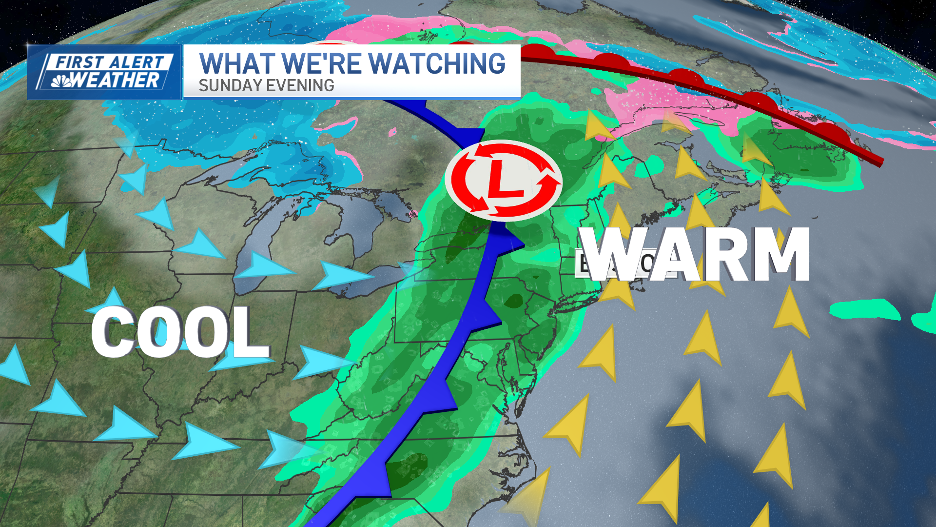
A front approaches from the west and a storm moves up the Eastern Seaboard Saturday. We're not too concerned with the storm, and the front is shedding showers as in closes in on the coast by afternoon. All told, we have a lot of dry hours — mostly early and late day.
WATCH ANYTIME FOR FREE
Stream NBC10 Boston news for free, 24/7, wherever you are. |

The mid/outer Cape and Nantucket have the best chance for a steady period of rain in the morning, then there too, it dries out in the afternoon. Temperatures are another story.
Get updates on what's happening in Boston to your inbox. Sign up for our News Headlines newsletter.
We'll see "peak" warmth in the morning, then a slide through the day, reaching the 40s late day.

Sunday dawns bright and chilly. We'll keep the breezes going, but the warmth is gone. Highs in the 40s, with an increase in clouds by afternoon. Few flurries could grace the Worcester Hills late day, too. Then, the focus turns to the big storm for Wednesday.
It's actually Tuesday night that the wind and rain arrive. Gusts could be 40-50+ from the southeast as the storm winds up. Downpours are likely, but they hit swiftly and move away.

This storm could linger as wind and some snowflakes into Thanksgiving, but the biggest impact will be on travel day Wednesday throughout the Northeast and Midwest.
Weather Stories

Plenty more details to follow. Enjoy the weekend!