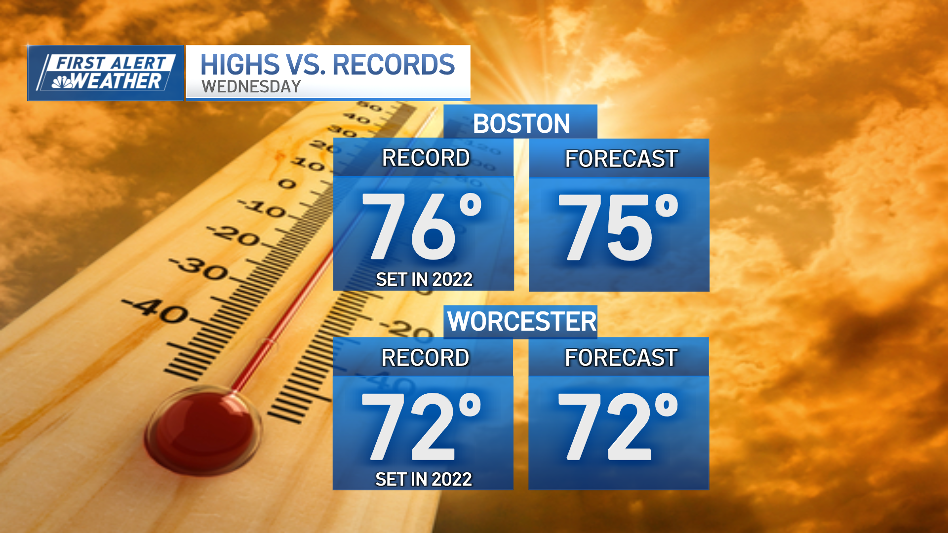
Mild temperatures Wednesday set record highs by afternoon, particularly in central and southern New England where most records were in the middle and upper 60s and were set on a warm Feb. 23 back in 2017.
Boston, Worcester, Hartford and Providence all set records.
WATCH ANYTIME FOR FREE
Stream NBC10 Boston news for free, 24/7, wherever you are. |
The warmth certainly is exceptional but also will be short-lived, as a sharp cold front progressing southeast from Canada will change the wind direction from southwest to northwest during the middle and late afternoon, opening the door to wintry air bottled up in southern Canada.
Get updates on what's happening in Boston to your inbox. Sign up for our News Headlines newsletter.
By Wednesday evening around dinnertime, temperatures will drop from the middle and upper 60s to the middle and upper 40s with a wind chill in the 30s, and even as skies clear with the arrival of the new, drier air, the cold nature of that air will continue to send temperatures on a free fall into the teens and 20s by dawn Thursday.
It’s the dry nature of the air that will mean a quiet Thursday aside from the chilly temperatures with the wind quieting steadily through the day and cirrus clouds – high altitude clouds often found in advance of a storm – increasing from afternoon to evening.
Weather Stories
By predawn Friday, snow begins across much of New England, arriving later in the morning over northeastern New England like northern New Hampshire and Maine.
When will the snow start Friday?
For most, snow will be falling by 3 to 5 a.m. and ramping up between 5 and 7 a.m. From 7 a.m. to noon, the heaviest precipitation falls, though a mix with sleet, freezing rain and rain will move into far southern New England during that time, and may ride as far north as northern Massachusetts.
How much will it snow on Friday in Massachusetts?
Although a mix would cap snow amounts, we think the snow falls fast enough in the first part of the storm that over half a foot would still be likely for many communities with closer to a foot in highest amounts.
Will Friday's storm cause power outages?
The ski areas of both southern and northern New England should make out well with this one, and while the winds will gust to 45 mph on Cape Cod as a change to rain takes hold Friday, wind speeds shouldn’t be damaging and this seems unlikely to be either a damaging storm or a blizzard.
With snow moving along Friday evening, the weekend looks fair and cool – perfect for winter sports – with cool air sticking around into early next week for New Hampshire’s school vacation week.
By midweek, a disturbance may deliver some Wednesday evening and night rain and snow showers ahead of slight warming expected by the end of the week in our exclusive First Alert 10-day forecast.
Get top local stories in Boston delivered to you every morning. Sign up for NBC Boston's News Headlines newsletter.


