


Today (Thursday): Early morning rain, snow showers. Becoming fair and chilly with highs in the 30s, wind chill 20s. Overnight Thursday Night: Clear and cold. Lows either side of 10, wind chill subzero. Friday: Sunny, wintry air. Highs in the 30s, 20s north.
Watch for sneaky icy and snowy spots on untreated surfaces Thursday morning, especially from the Massachusetts Turnpike and north. It doesn’t take much to make roads slick, and a clipper system is moving through this morning.
STAY IN THE KNOW
Watch NBC10 Boston news for free, 24/7, wherever you are. |
|
Get Boston local news, weather forecasts, lifestyle and entertainment stories to your inbox. Sign up for NBC Boston’s newsletters. |


Snow showers will be light in northern New England, with a wintry mix to light rain between midnight and 5 a.m. south.
This system drops scattered coatings to 1” of a snow mix across higher terrain of Massachusetts and northern Connecticut, to coatings to 1-2” around Vermont, New Hampshire and Maine.
Get top local stories in Boston delivered to you every morning. Sign up for NBC Boston's News Headlines newsletter.


After it moves out, we’ve seen the last of the fast-moving weather systems this week. Next up is a couple of slow-movers at the tail end of the weekend.
But we’re busy with the cold in the coming days. Thursday won’t be all that chilly. Highs at least crack freezing after our little dose of snow and rain earlier this morning. Cold is being transported into the area at all levels, so the wind will be brisk and the temperatures don’t get very far from the mid-30s.
Weather Stories


Numbing cold settles in by morning on Friday. Temperatures will start in the single digits and teens, and highs by afternoon will be within a degree or two of freezing. Only good part of that forecast is that it’s Friday, it’s not windy, and the sun is out. It’s also shaping up to be the coldest day we’ll see for a while.
The weekend sees the milder air slowly take hold as a couple of storm systems take aim. We'll see 40s Saturday and near 60 on Sunday with the first storm moving in.
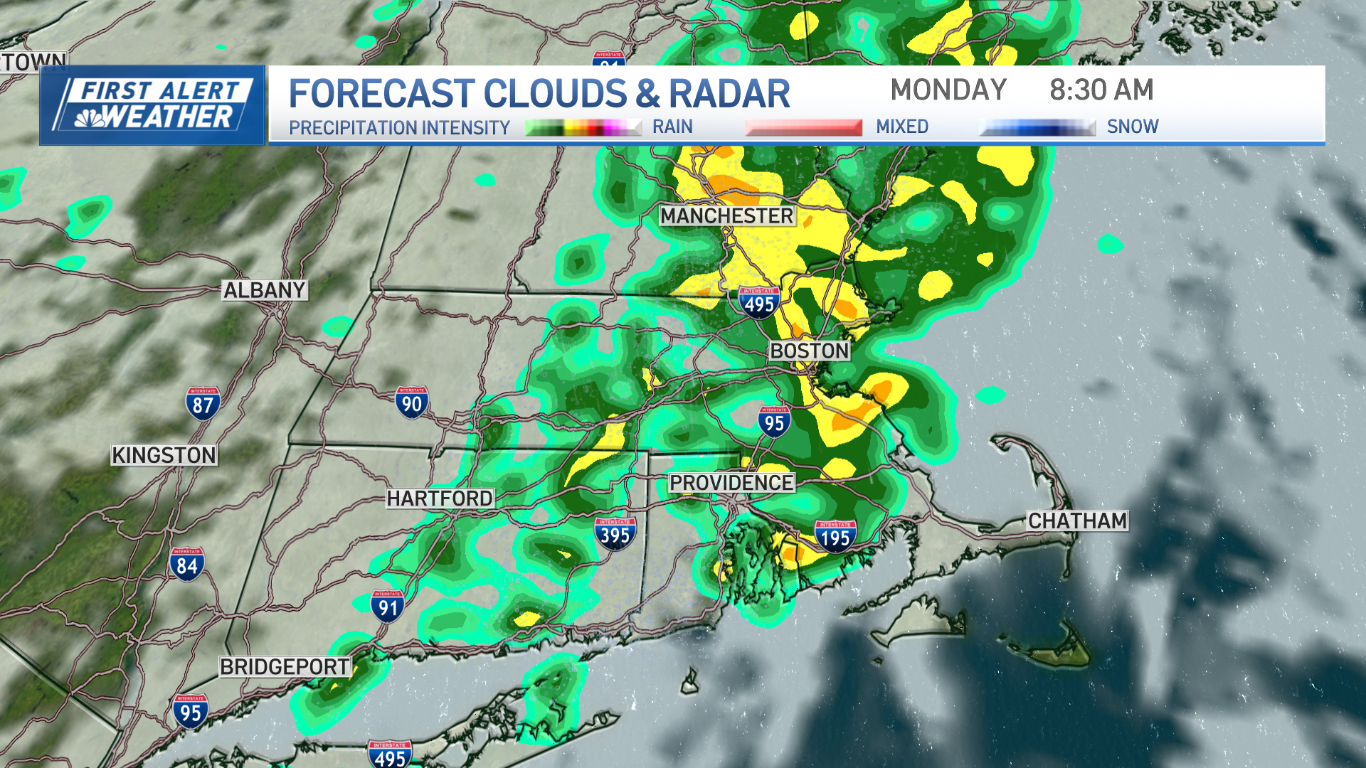
Rain will be intermittent Sunday, but we could be looking at a soaker on Monday with some of that milder air hanging around.
Monday’s temperature forecast is kind of tricky, too. We’re right on the boundary of the cold/warm air, and a slight shift in the wind direction could mean the difference between 40s or 60s.
Spring suspense has begun!
