Today: Sun and clouds. Highs in the 70s. Overnight Wednesday Night: Chance passing shower. Lows in the 60s. Thursday: A period of rain & thunder, humid AM. Drying out late. Highs around 70.
We’re shaking off the clouds and showers Wednesday, but it may take some time. El Sol goes to bed early and gets up late these days (wait ‘til you see him in December), and the task is arduous. Thick overcast will slowly erode by late morning - or early afternoon for the more stubborn patches – but the temperatures bounce back to the low 70s, nonetheless.
A fast-moving front will be on top of us first thing Thursday. All indications are showing the showers will get a jump on us early, and be slow to depart in the afternoon. We should see SOME amount of sun before it sets, but it’s hard to pin down exactly when the clouds may break. Best case scenario clears us by 1-3 p.m., worst case 5-7 p.m. Why the discrepancy and doubt? Fiona, of course.
WATCH ANYTIME FOR FREE
Stream NBC10 Boston news for free, 24/7, wherever you are. |

As the hurricane closes the gap on Bermuda Thursday, it’s holding up the wagon train of weather systems across the Northeast. That means our front could slow to a crawl through New England Thursday, or if Fiona begins its acceleration to the north sooner, skies could clear more quickly. I’m placing my money on the former. Fronts typically put on the brakes as the upper air currents conspire to capture the hurricane and fling it toward the Maritime Provinces.
Get updates on what's happening in Boston to your inbox. Sign up for our News Headlines newsletter.
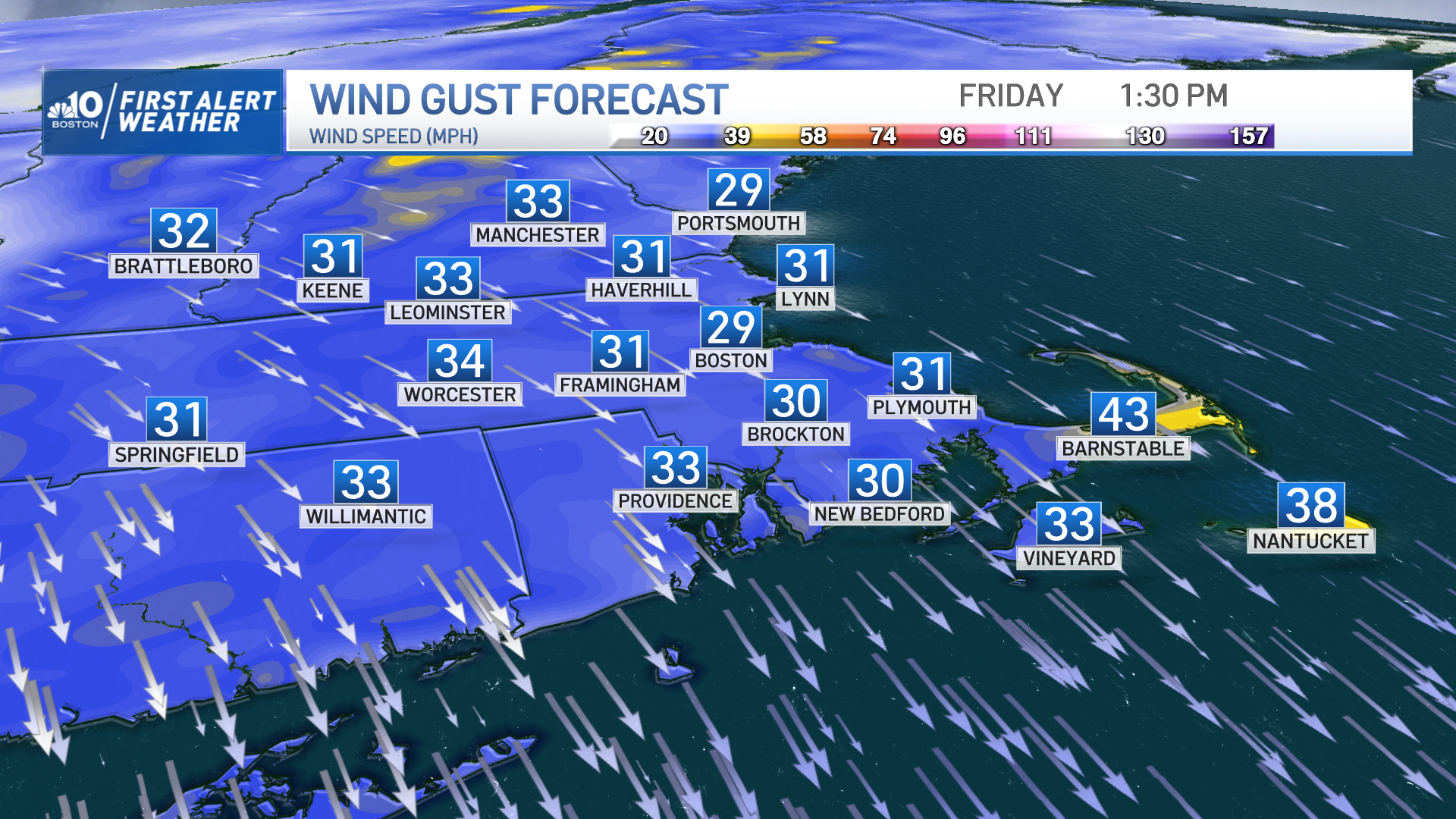
Once the upper atmosphere has Fiona in hand, it will shove an unseasonably cool airmass down into New England on Friday. Highs will struggle to make 60 amidst a gusty, dry wind. We don’t have wind chill values for temps near 60, but suffice it to say, it won’t feel nearly that warm.
A superb weekend awaits! Saturday starts with a deep fallish feel with morning temps in the 30s (!) and 40s warming to the mid-60s. Sunday sees us recover to the 70s with an increase in afternoon clouds.
Weather Stories
Make the best of the day!

