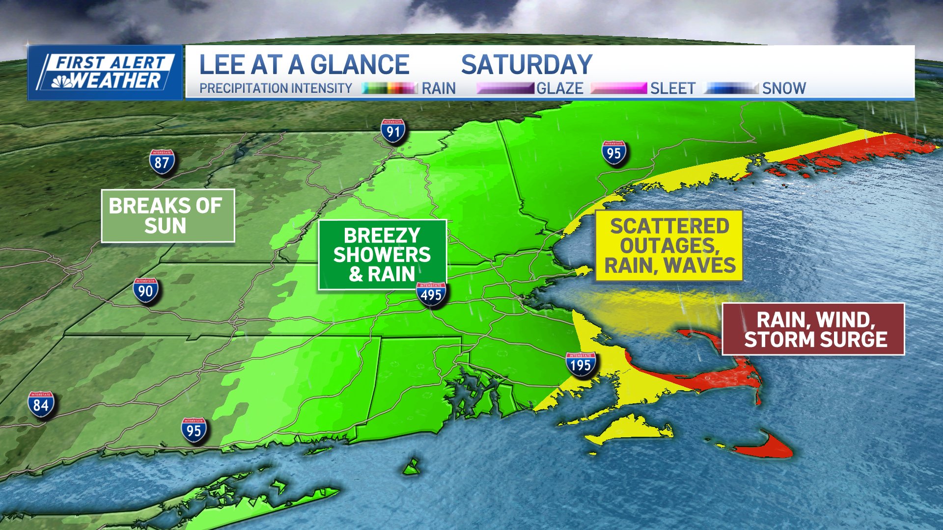
All eyes will be on Hurricane Lee as it moves north between Bermuda and the Outer Banks of North Carolina the rest of Thursday and Friday.
A tropical storm warning had already been in place on Cape Cod, Martha's Vineyard and Nantucket. Thursday afternoon, that warning was extended along the coast, from the Massachusetts-Rhode Island state line to the Canadian border in Maine.
WATCH ANYTIME FOR FREE
>Stream NBC10 Boston news for free, 24/7, wherever you are. |
A hurricane watch is also in effect along Maine's coast from Stonington to the Canadian border.
Get updates on what's happening in Boston to your inbox. Sign up for our >News Headlines newsletter.
See the latest from the National Hurricane Center here.
Mid and high clouds will increase starting Thursday night and will continue through the day Friday. Gradually, there will also be an increase in wind.
Friday night through Saturday night will have the highest level of impact from Lee. The impact peak will likely be early Saturday afternoon, with things winding down Saturday night.
By Sunday, we will be back to sunshine, lighter winds and comfortable temperatures.
Beach erosion, tree damage and power outages will be the main threat. A storm surge of 1 to 3 feet is expected Saturday, especially for north-facing coastal areas. A storm surge watch had been in issued for parts of Massachusetts, but that was no longer in effect in the Bay State as of 5 p.m.
Stay weather-aware, as a small shift in the track could have more or less impact on New England.


