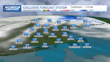
Winter has returned in full force on Thursday with gusty west winds, wind chills in the teens and 20s, highs in the 30s, and some lingering flurries.
More specifically, in Maine we continue to see the low pressure system slowly move out Thursday, but lingering snow showers continue to coat untreated backroads with fresh snow.
WATCH ANYTIME FOR FREE
>Stream NBC10 Boston news for free, 24/7, wherever you are. |
The morning flurries across southern New England dissipate. A few lake effect snow showers stretch into the Berkshires on Thursday thanks to the strong wind off of Lake Ontario. The strong wind from the west will be high enough in higher terrain to produce 50 mph gusts that may lead to branches blown around, and isolated outages.
Get updates on what's happening in Boston to your inbox. Sign up for our >News Headlines newsletter.
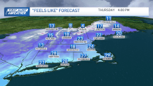
The sky clears into Friday with more sunshine, less wind and highs in the low 40s.
First Alert for northern New England due to Saturday snowstorm
Weather Stories
The weekend brings us another chance for precipitation on Saturday.
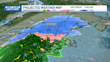
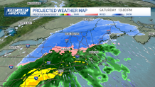
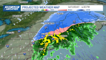
A First Alert has been declared for northern New England due to heavy snow. The snow begins late Friday night and lasts through Saturday night.
How much snow are we getting this weekend?
Around 6 inches of snow is forecast across Vermont, central to northern New Hampshire, and interior Maine. There is a sharp cutoff as you head south or to the coast. Around 2 inches of snow will only fall around southern New Hampshire and northern Massachusetts. A coating to 2 inches of snow is in the forecast around Boston and along the Mass Pike to areas north, with no snow to the south.
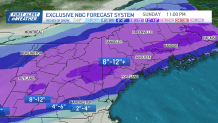
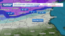
Mainly rain falls across southern New England and around Boston with 1-3 inches of rainfall through Saturday. Sunday we see some sun between the clouds as highs cool to the upper 30s.
Two more storm chances next week
Next week, there is a chance for an offshore storm to head north, swinging in some showers but mainly clouds around New England. For now, we’re keeping it dry for Monday and early Tuesday, but that may change. Showers return late Tuesday into midweek.
A system stalls a bit over us for the end of the week as well, keeping showers in through Thursday at least. Temps become milder by then with highs in the low 50s.


