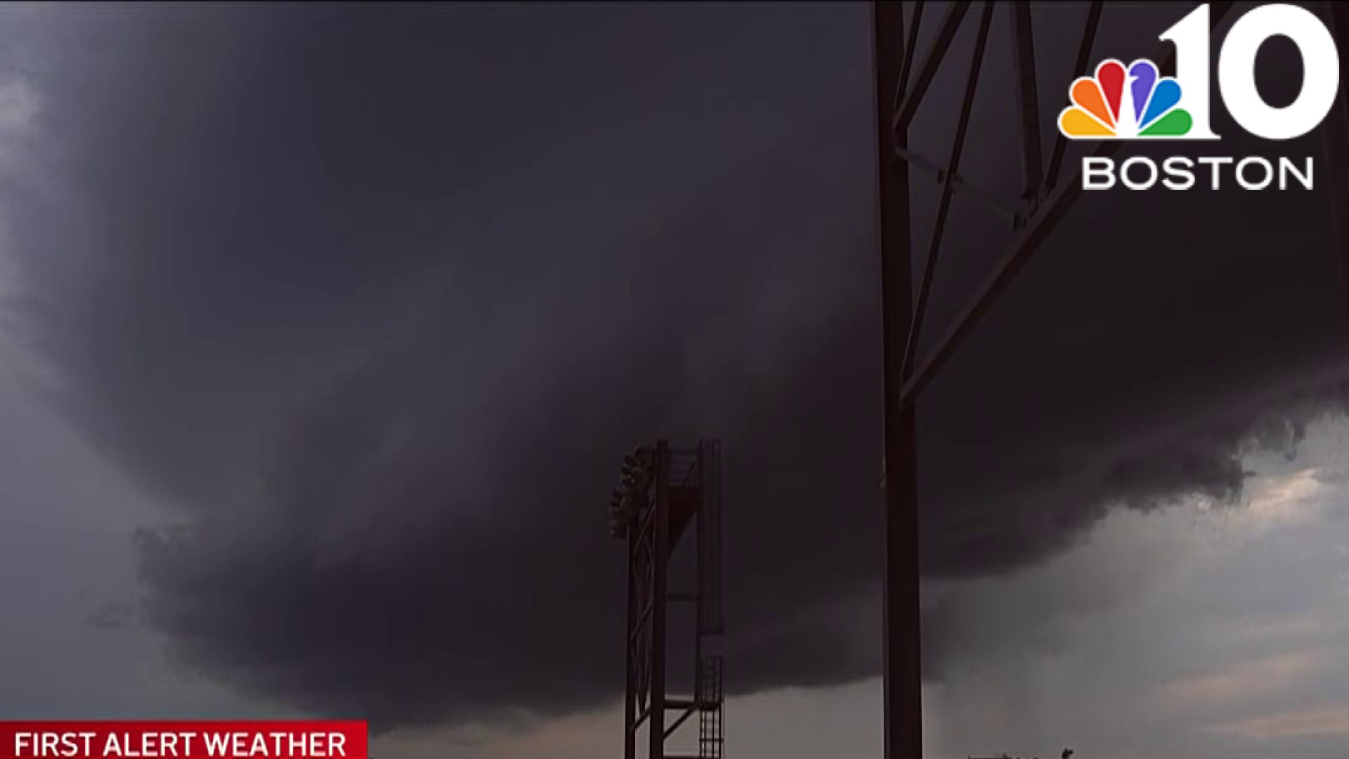
A very warm and humid afternoon is ahead which is setting the stage for severe storms to develop now through early tonight along a cold front sliding across the region.
The main threat with these storms will be damaging wind, hail, and heavy rain which may cause localized flooding, an isolated tornado is possible as well, timing will be between 1-2pm through around 9pm early tonight.
STAY IN THE KNOW
Watch NBC10 Boston news for free, 24/7, wherever you are. |
|
Get Boston local news, weather forecasts, lifestyle and entertainment stories to your inbox. Sign up for NBC Boston’s newsletters. |
A tornado warning has been issued for Aroostook county in Maine. It expires at 3:15 p.m.
A severe thunderstorm warning was issued for Kent, Washington and Providence counties in Rhode Island until 3:30 p.m.
A severe thunderstorm warning was issued for Fairfield, Middlesex, Windham, Tolland, Hartford and New Haven counties in CT until 3 p.m.
In New Hampshire, a severe thunderstorm warning has been issued for northern parts of the state through 3:30 p.m.
The National Weather Service has issued a severe thunderstorm warning for Hampden county in Massachusetts and Orange, Caledonia and Washington counties in Vermont.
The warning expired at 2:30 p.m.
A thunderstorm warning has also been issued for Aroostook, Penobscot and Piscataquis counties in Maine.
The warning expires at 3 p.m.
A flash flood warning has also been issued for Hartford, New Haven and Litchfield counties in Connecticut. This warning expires at 5:15 p.m.
Click here to see all the weather alerts

Storms will develop over western MA into Vermont and New Hampshire and slide eastward into the Boston area by 3PM and eventually making into southeast MA by 5pm, more storms will likely develop throughout the evening into early tonight before winding down by around 9-10pm.
High temperatures will reach the mid to upper 80s, mid to upper 70s Cape and Islands.
Monday will feature drier conditions with some morning sunshine and building afternoon clouds, some of which may produce an isolated shower or storm.
Highs in the mid to upper 70s with lower humidity. We remain on the dry side with low humidity and temperatures in the 80s both Tuesday and Wednesday.

Warmer, a bit more humid Independence Day with an isolated afternoon shower or storm. Highs in the mid to upper 80s.
Have a great Sunday!